> For the complete documentation index, see [llms.txt](https://docs.geopard.tech/geopard-tutorials/llms.txt). Markdown versions of documentation pages are available by appending `.md` to page URLs; this page is available as [Markdown](https://docs.geopard.tech/geopard-tutorials/gis-quick-hints/qgis-yield-data-manipulations.md).
# QGIS: Yield Data Manipulations
OVERVIEW
Manual with step-by-step description to resolve the following troubles with data from yield monitor:
1. Missed projection file (.prj) in shapefile
2. Apply conversion rules for every attribute in shapefile (based on kb/ha to bu/ac sample)
The software to utilize is QGIS ([LINK](https://qgis.org/en/site/forusers/download.html)).
Downloading and installation are mandatory.
### MISSED PROJECTION FILE
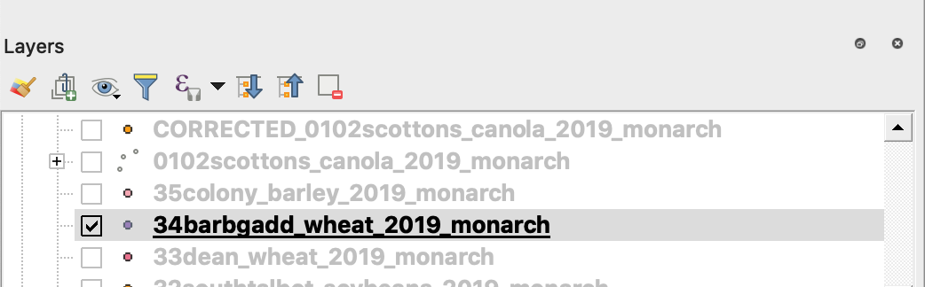
1. Open shapefile with yield data. Move the file inside the QGIS window.
2. The shapefile becomes available for further manipulations in the Layers block.
3. Start saving process
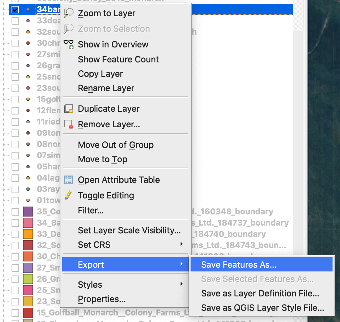
4. 1. Do the right mouse button and click at the shapefile
2. Choose Export -> Save Feature As ...
4. Choose
5. 1. Format -> ESRI Shapefile,
2. Filename -> click … and select the preferred directory and filename,
3. CRS -> EPSG:4326
4. Encoding -> UTF8
5. Add saved file to map (optional if you want to see it directly in QGIS)
6. Geometry type -> Point
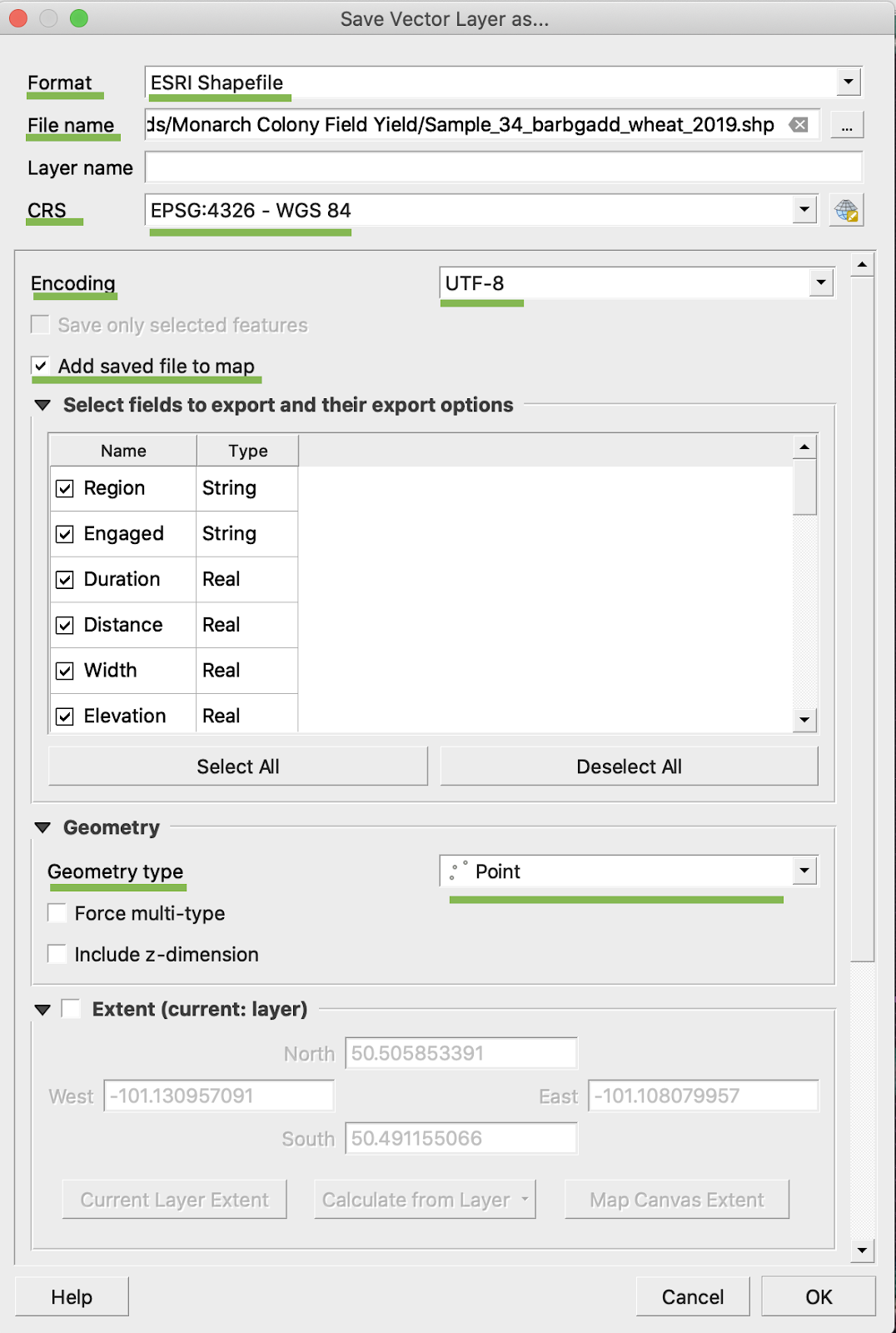
5. Click Ok
6. An additional shapefile with the same yield data is created. The projection file (.prj) was added.
\
### BU/AC CONVERSION
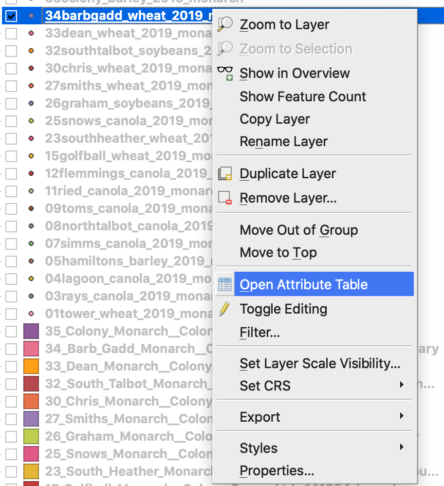
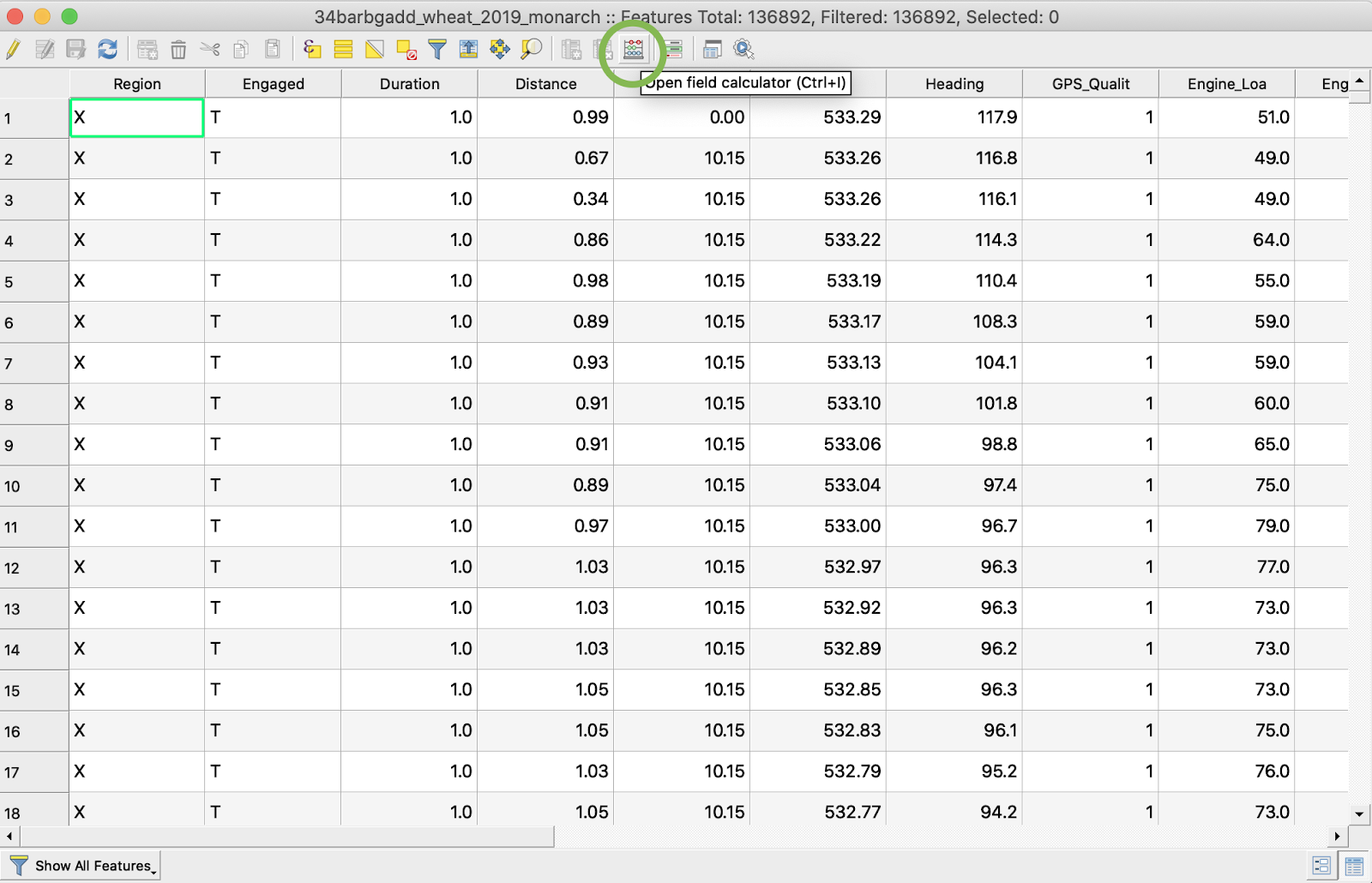
1. Do the right mouse button click on the shapefile and choose Open Attribute Table
2. Click Open field calculator
3. Create a new field
4. 1. Mark Create a new field
2. Enter Output field name -> DryYieldBu
3. Choose Output field type -> Decimal number (real)
4. Change Precision -> 4
5. Put rule to convert kg/ha to bu/ac -> "Dry\_Yield" \* 0.0149
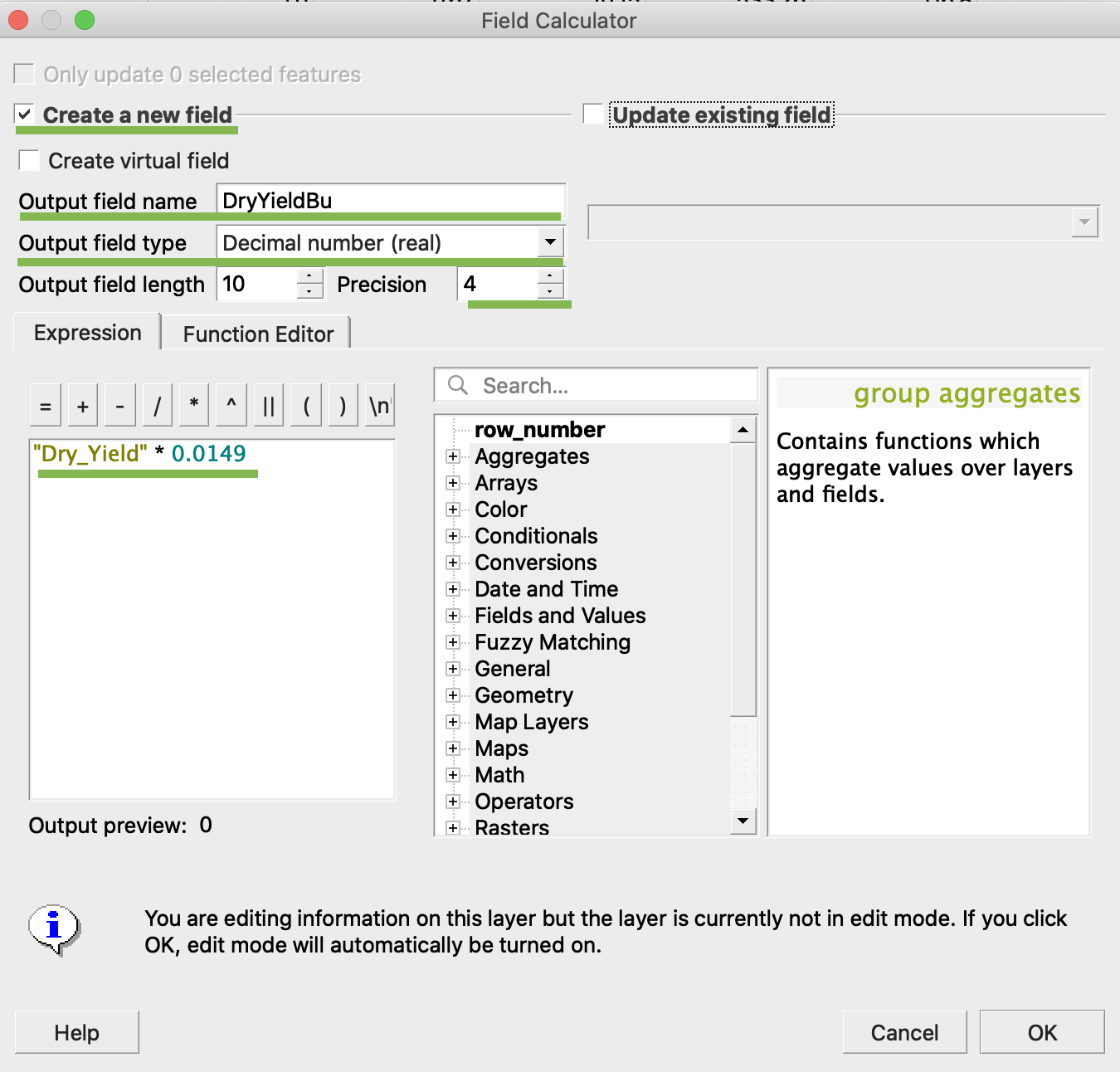
4. Click Ok
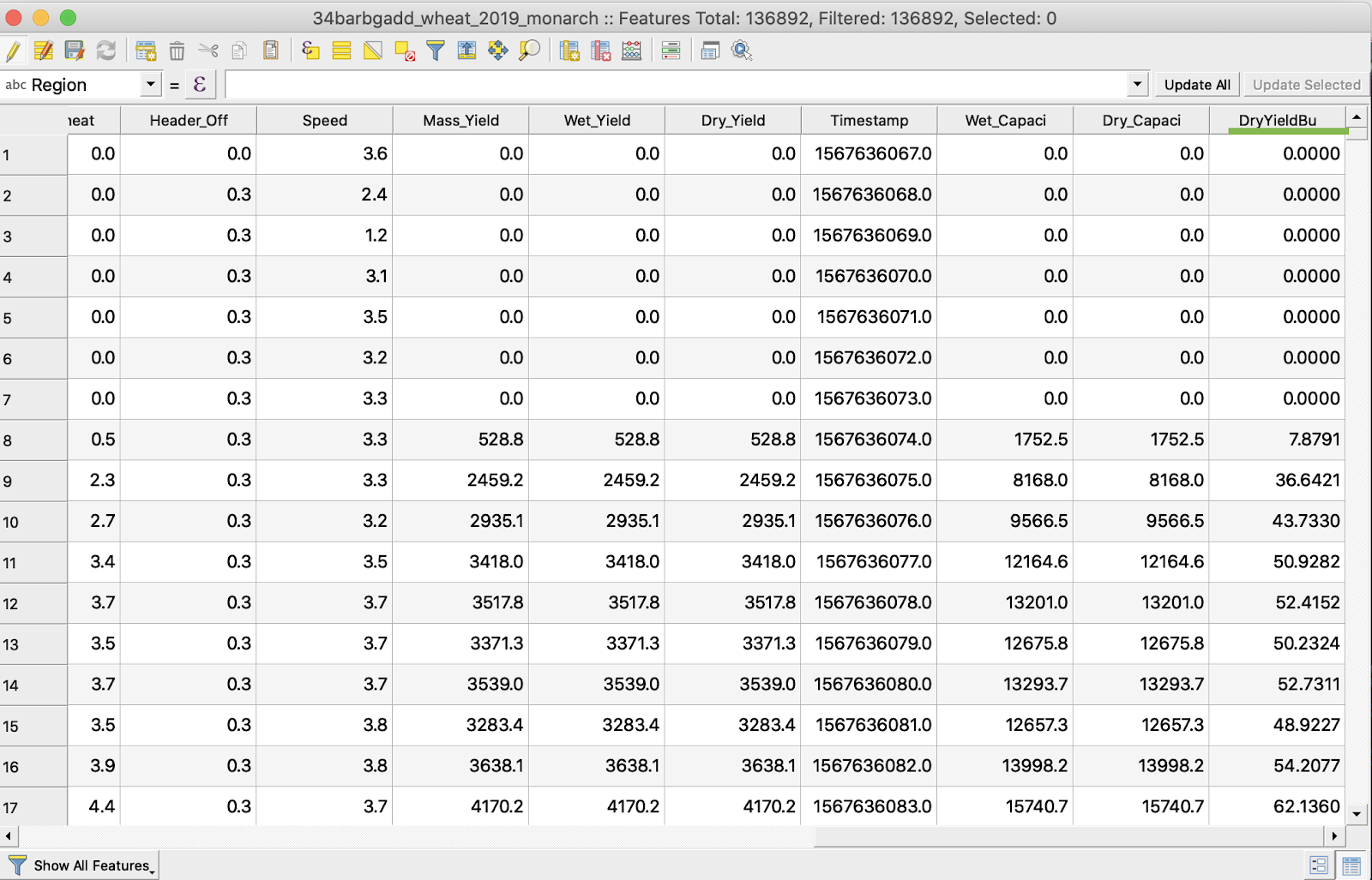
5. Additional DryYieldBu attribute has appeared in the table
6. Save the changes
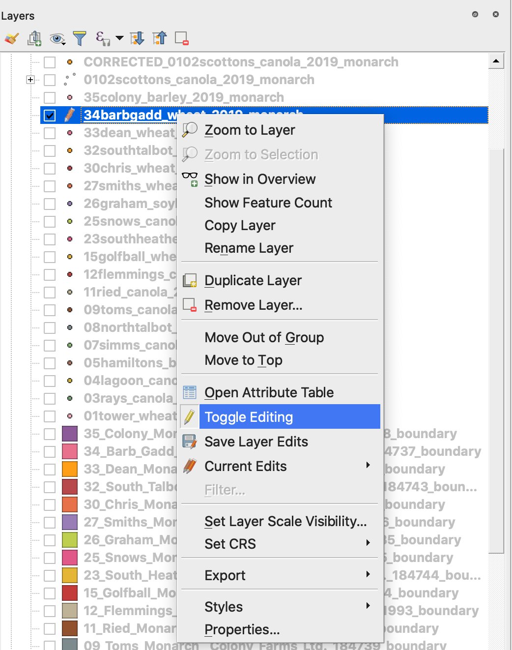
7. 1. Do the right mouse button click on the interested shapefile
2. Choose Toggle Editing
\
\
\
7. Confirm saving the changes
The interested shapefile is not marked with Pencil anymore. The data in the shapefile was updated.
---
# Agent Instructions
This documentation is published with GitBook. GitBook is the documentation platform designed so that both humans and AI agents can read, navigate, and reason over technical content effectively. Learn more at gitbook.com.
## Querying This Documentation
If you need additional information that is not directly available in this page, you can query the documentation dynamically by asking a question.
Perform an HTTP GET request on the current page URL with the `ask` query parameter, and the optional `goal` query parameter:
```
GET https://docs.geopard.tech/geopard-tutorials/gis-quick-hints/qgis-yield-data-manipulations.md?ask=&goal=
```
`ask` is the immediate question: it should be specific, self-contained, and written in natural language.
`goal` is optional and describes the broader end goal you are ultimately trying to accomplish on behalf of the user. GitBook uses it to tailor the answer towards what is most useful for that goal.
The response will contain a direct answer to the question and relevant excerpts and sources from the documentation.
Use this mechanism when the answer is not explicitly present in the current page, you need clarification or additional context, or you want to retrieve related documentation sections.