.png?alt=media&token=cd1d6129-b263-498c-8b8c-608b963ef7ac)
Smoother and More Accurate Zone Maps
Smoother and More Accurate Zone Maps

Better User Experience on Low-Resolution Screens

Automatic Yield Attribute Selection
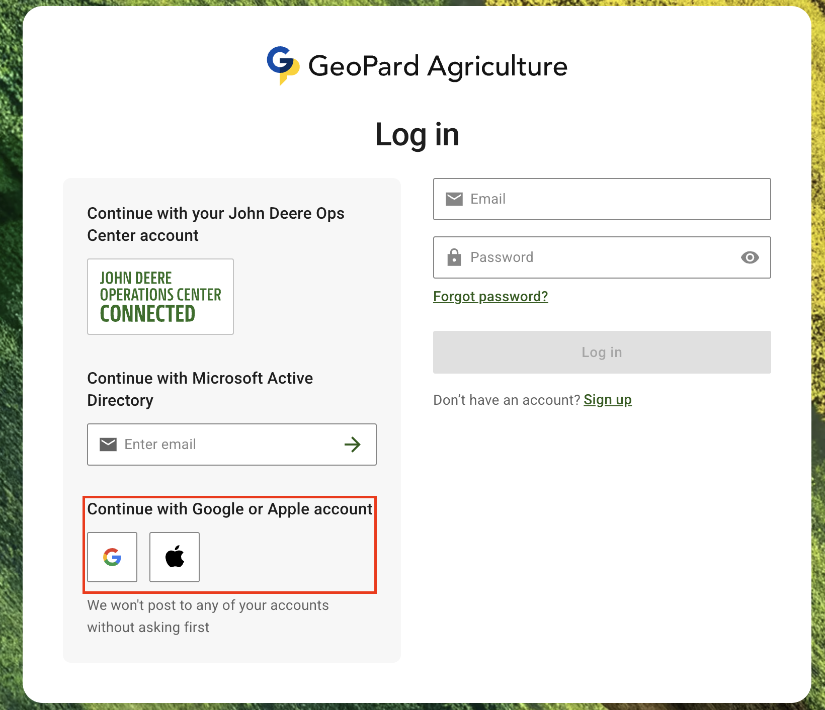
Sign In with Apple
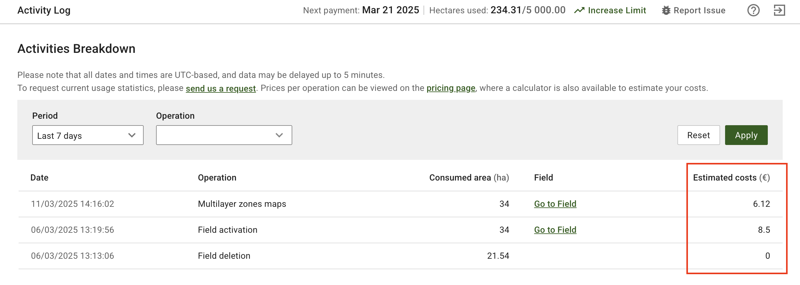
Estimated Costs in Activity Log
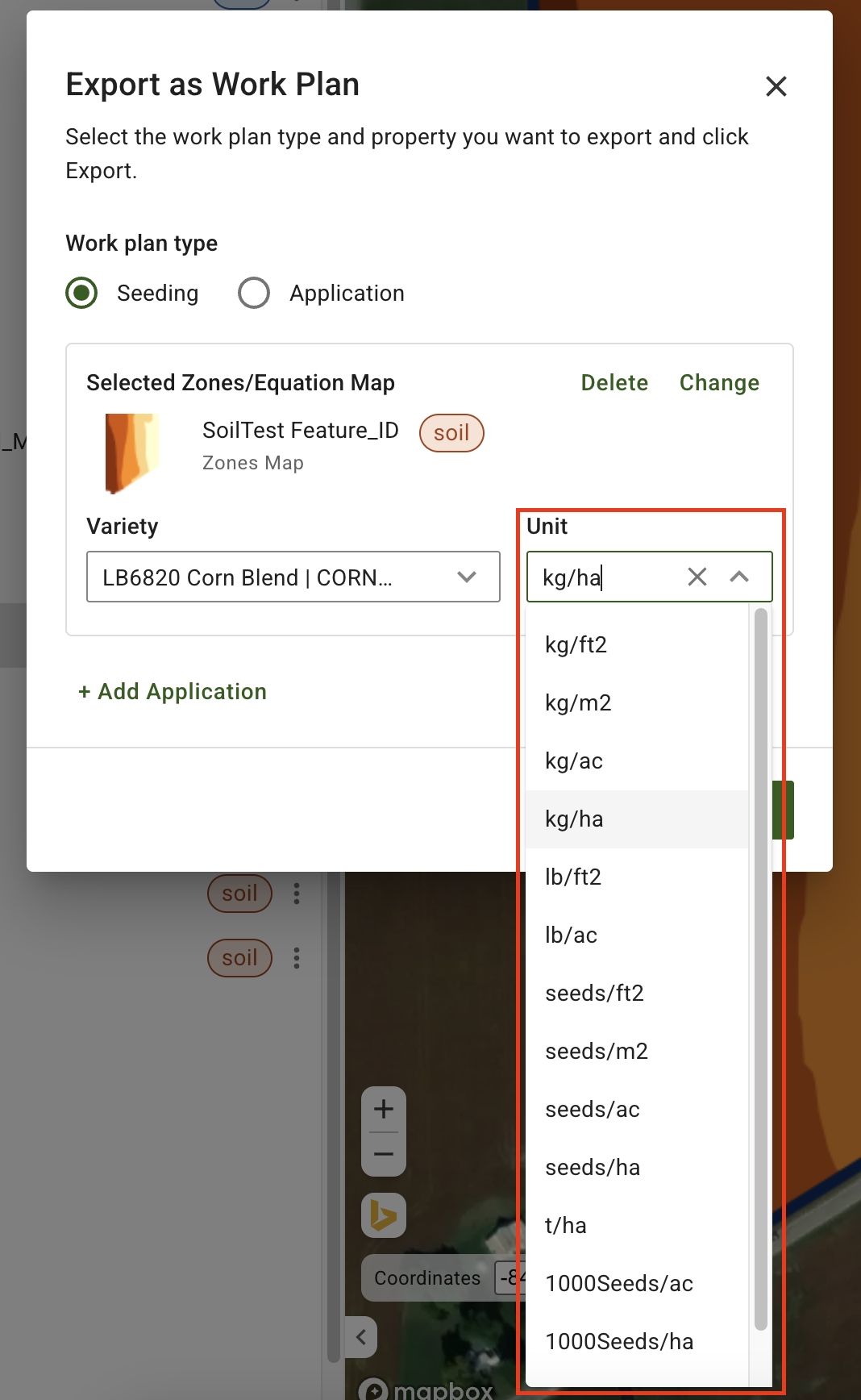
Support for Any Unit in John Deere Work Plans

First Month Cost Calculator Updates