> For the complete documentation index, see [llms.txt](https://docs.geopard.tech/geopard-tutorials/llms.txt). Markdown versions of documentation pages are available by appending `.md` to page URLs; this page is available as [Markdown](https://docs.geopard.tech/geopard-tutorials/gis-quick-hints/qgis-split-multi-field-shapefiles.md).
# QGIS: Split Multi-field Shapefiles
If one shapefile contains several field polygons, split it before import. GeoPard imports one field boundary per shapefile. This QGIS workflow helps you prepare clean files faster and avoid import issues.
### Before you start
* Make sure the layer has a unique field name or ID.
* Create an empty output folder in advance.
* Remove `/`, `\`, and similar special characters from field names.
### Split a multi-field shapefile in QGIS
#### 1. Open the shapefile in QGIS
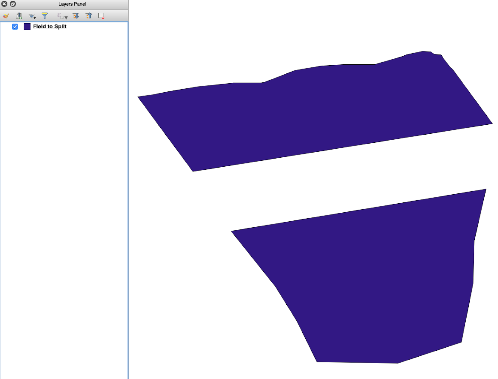
Open the source shapefile in QGIS. Confirm it contains multiple field polygons.
Initial field boundary layer with multiple polygons.
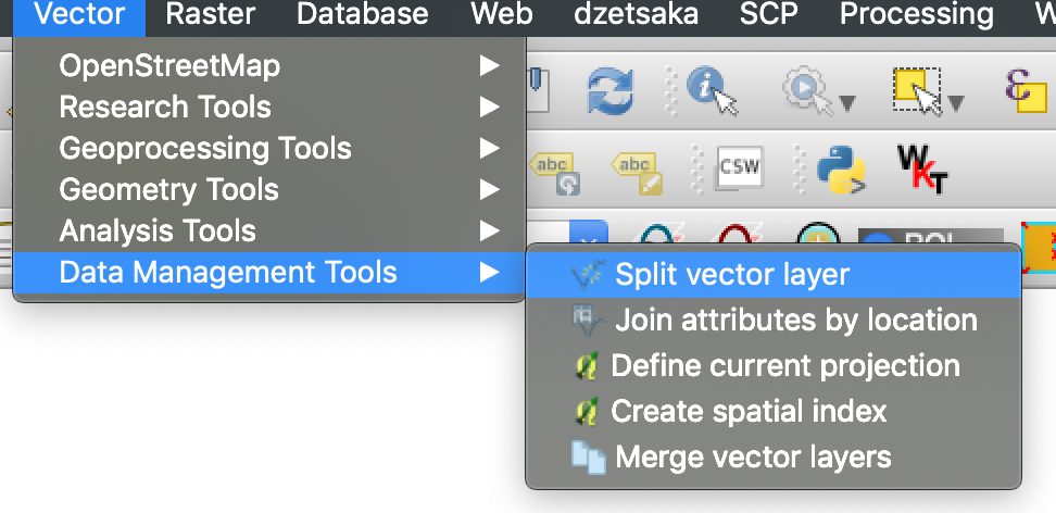
#### 2. Open the split tool
Open the layer options and choose **Split vector layer**.
Open the split workflow.
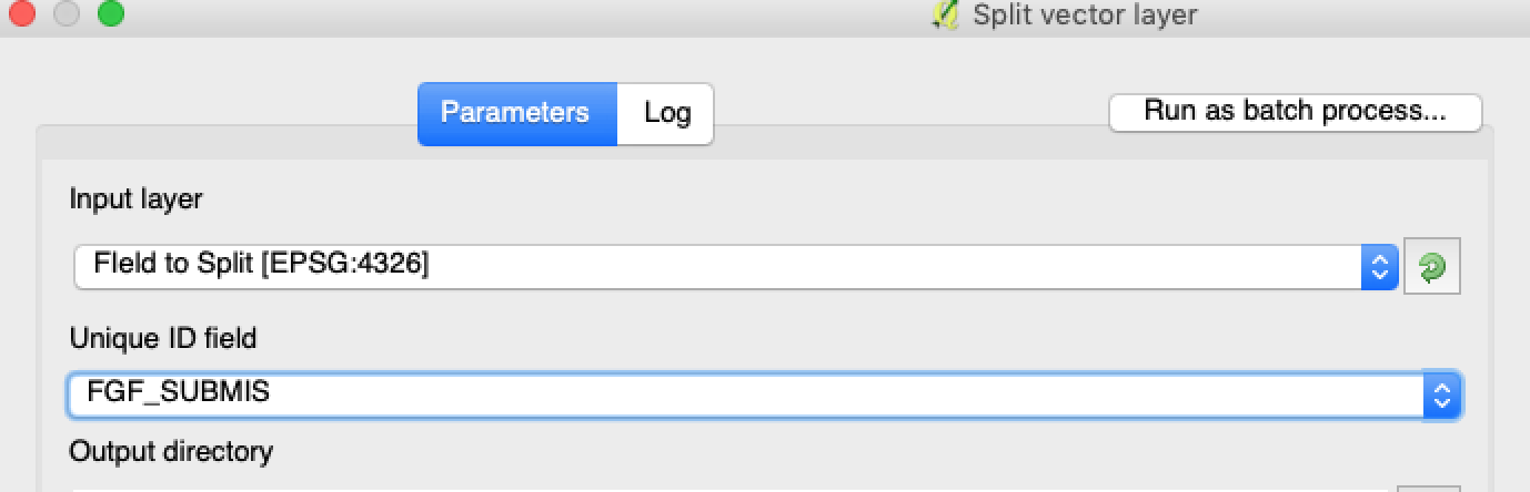
#### 3. Choose the layer, attribute, and output folder
Set:
1. The layer to split.
2. A unique attribute for each field.
3. The output directory.
Select the source layer and split attribute.
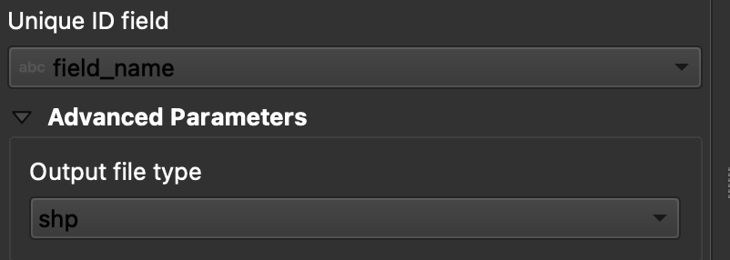
#### 4. Set the output format
Choose **ESRI Shapefile** as the output format.
Set the output folder and shapefile format.
#### 5. Run the split
Click **Run**. QGIS creates one file per polygon. Each polygon becomes a separate field boundary shapefile.
#### 6. Convert `.gpkg` files to `.shp` if needed
Some QGIS setups create `.gpkg` files first. If that happens, open each file and save it again as **ESRI Shapefile**.
1. Right-click the layer.
2. Select **Export** → **Save Features As**.
3. Choose **ESRI Shapefile**.
4. Set the file name and location.
5. Remove unneeded attributes if needed.
### Result
You now have one shapefile per field. Each file is ready for field boundary upload in GeoPard. This saves setup time and reduces avoidable import rework.
### Related QGIS guides
* [QGIS: Convert CSV to SHP](/geopard-tutorials/gis-quick-hints/qgis-convert-csv-to-shp.md)
* [QGIS: Reproject Shapefile](/geopard-tutorials/gis-quick-hints/qgis-reproject-shapefile.md)
---
# Agent Instructions
This documentation is published with GitBook. GitBook is the documentation platform designed so that both humans and AI agents can read, navigate, and reason over technical content effectively. Learn more at gitbook.com.
## Querying This Documentation
If you need additional information that is not directly available in this page, you can query the documentation dynamically by asking a question.
Perform an HTTP GET request on the current page URL with the `ask` query parameter, and the optional `goal` query parameter:
```
GET https://docs.geopard.tech/geopard-tutorials/gis-quick-hints/qgis-split-multi-field-shapefiles.md?ask=&goal=
```
`ask` is the immediate question: it should be specific, self-contained, and written in natural language.
`goal` is optional and describes the broader end goal you are ultimately trying to accomplish on behalf of the user. GitBook uses it to tailor the answer towards what is most useful for that goal.
The response will contain a direct answer to the question and relevant excerpts and sources from the documentation.
Use this mechanism when the answer is not explicitly present in the current page, you need clarification or additional context, or you want to retrieve related documentation sections.