> For the complete documentation index, see [llms.txt](https://docs.geopard.tech/geopard-tutorials/llms.txt). Markdown versions of documentation pages are available by appending `.md` to page URLs; this page is available as [Markdown](https://docs.geopard.tech/geopard-tutorials/ukrainian/oglyad-produktu-vebdodatok/karti-zon-i-analitika/stvoriti-kartu-zon-za-dopomogoyu-suputnikovikh-znimkiv.md).
# Створити карту зон за допомогою супутникових знімків
Створюйте зони управління на основі супутникових знімків, щоб виявляти варіабельність і підтримувати рішення щодо змінних норм внесення.
1. Виберіть поле у списку, натисніть **Створити карту зон** кнопку, виберіть **Одношаровий**, а потім натисніть **Далі**.
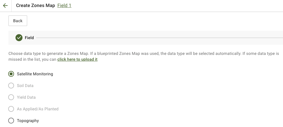
2. Вибрати **Супутниковий моніторинг** тип даних, щоб продовжити.
3. На наступному кроці ви можете вибрати супутникове зображення. Ви можете фільтрувати за місяцем, роком, постачальником або NDVI, а також перемикатися між режимами перегляду зображень, такими як NIR і EVI2. **Ось короткий опис типів індексів** посилання пояснює доступні індекси. Якщо вам потрібно змінити індекс, натисніть стрілку поруч із **EVI2**. Потім натисніть **Далі**.
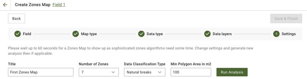
4. На наступному кроці ви можете відредагувати назву, змінити кількість зон, [вибрати тип класифікації даних](/geopard-tutorials/ukrainian/oglyad-produktu-vebdodatok/karti-zon-i-analitika/vikoristannya-klasifikaciyi-danikh.md), і визначити мінімальну площу полігона в квадратних метрах. Натисніть **Запустити аналіз** щоб продовжити.
Аналіз може тривати до 60 секунд, залежно від заданих вами параметрів.
5. Після завершення натисніть **Зберегти й завершити**.
Після збереження ви побачите таке повідомлення:
Ви можете створити ще одну карту зон, призначити норми або відкрити щойно створену карту зон. Якщо ви її відкриєте, побачите подібний вигляд.
---
# Agent Instructions
This documentation is published with GitBook. GitBook is the documentation platform designed so that both humans and AI agents can read, navigate, and reason over technical content effectively. Learn more at gitbook.com.
## Querying This Documentation
If you need additional information that is not directly available in this page, you can query the documentation by asking a question.
Perform an HTTP GET request on the following URL with the `ask` and `goal` query parameters:
```
GET https://docs.geopard.tech/geopard-tutorials/ukrainian/oglyad-produktu-vebdodatok/karti-zon-i-analitika/stvoriti-kartu-zon-za-dopomogoyu-suputnikovikh-znimkiv.md?ask=&goal=
```
`ask` is the immediate question: it should be specific, self-contained, and written in natural language.
`goal` is what the user is ultimately trying to achieve, the reason they need the answer. Sharing it helps GitBook give you a better, more relevant answer. A goal is most helpful when it describes the outcome the user wants rather than restating the question. For example, with `ask=how do I create an API token`, a goal like `automate deployments from our CI pipeline` lets GitBook tailor the answer to that use case.
The response will contain a direct answer to the question and relevant excerpts and sources from the documentation.
Use this mechanism when the answer is not explicitly present in the current page, you need clarification or additional context, or you want to retrieve related documentation sections.