> For the complete documentation index, see [llms.txt](https://docs.geopard.tech/geopard-tutorials/llms.txt). Markdown versions of documentation pages are available by appending `.md` to page URLs; this page is available as [Markdown](https://docs.geopard.tech/geopard-tutorials/tr/urun-turu-web-uygulamasi/bolgeler-haritalari-ve-analitigi/cok-yilli-bolgeler.md).
# Çok Yıllı Bölgeler
Uzun vadeli ziraat kararlarını desteklemek için çok yıllı verilerden kararlı yönetim bölgeleri oluşturun.
Tarihsel (çok yıllık) yönetim bölgeleri, tarladaki her nokta hakkında içgörüler sağlar.
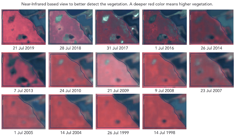
Tarihsel (çok yıllık) yönetim bölgeleri, 30+ yıllık uydu görüntüsü arşivi temel alınarak oluşturulur. Her sezonda bitki gelişiminin zirve yaptığı görüntüler, analizler için girdi olarak otomatik seçilir. Aksi halde, bu tür her görüntü ilgili yıl için potansiyel bir verim dosyasını temsil eder.
Tarla ürün gelişim deseni, tarım alanını daha iyi tanımaya ve doğru girdi oranlarıyla doğru kararı doğru noktalarda uygulamaya yardımcı olur. Tarihsel yönetim bölgeleri, ekim, gübreleme ve bölge bazlı toprak örneklemesi için reçete (Rx) dosyalarına bir temel olarak kullanılabilir.
---
# Agent Instructions
This documentation is published with GitBook. GitBook is the documentation platform designed so that both humans and AI agents can read, navigate, and reason over technical content effectively. Learn more at gitbook.com.
## Querying This Documentation
If you need additional information that is not directly available in this page, you can query the documentation by asking a question.
Perform an HTTP GET request on the following URL with the `ask` and `goal` query parameters:
```
GET https://docs.geopard.tech/geopard-tutorials/tr/urun-turu-web-uygulamasi/bolgeler-haritalari-ve-analitigi/cok-yilli-bolgeler.md?ask=&goal=
```
`ask` is the immediate question: it should be specific, self-contained, and written in natural language.
`goal` is what the user is ultimately trying to achieve, the reason they need the answer. Sharing it helps GitBook give you a better, more relevant answer. A goal is most helpful when it describes the outcome the user wants rather than restating the question. For example, with `ask=how do I create an API token`, a goal like `automate deployments from our CI pipeline` lets GitBook tailor the answer to that use case.
The response will contain a direct answer to the question and relevant excerpts and sources from the documentation.
Use this mechanism when the answer is not explicitly present in the current page, you need clarification or additional context, or you want to retrieve related documentation sections.