> For the complete documentation index, see [llms.txt](https://docs.geopard.tech/geopard-tutorials/llms.txt). Markdown versions of documentation pages are available by appending `.md` to page URLs; this page is available as [Markdown](https://docs.geopard.tech/geopard-tutorials/tr/gis-kisa-ipuclari/qgis-verim-verisi-islemleri.md).
# QGIS: Verim Verisi İşlemleri
GeoPard'a içe aktarmadan veya analiz etmeden önce verim verisini QGIS'te hazırlayın ve temizleyin.
GENEL BAKIŞ
Verim monitörü verileriyle aşağıdaki sorunları çözmek için adım adım açıklamalı kılavuz:
1. Shapefile içinde eksik projeksiyon dosyası (.prj)
2. Shapefile’daki her öznitelik için dönüşüm kurallarını uygulayın (kb/ha’dan bu/ac örneğine göre)
Kullanılacak yazılım QGIS’tir ([BAĞLANTI](https://qgis.org/en/site/forusers/download.html)).
İndirme ve kurulum zorunludur.
### EKSİK PROJEKSİYON DOSYASI
1. Verim verilerini içeren shapefile’ı açın. Dosyayı QGIS penceresinin içine sürükleyin.
2. Shapefile, Katmanlar bölümünde sonraki işlemler için kullanılabilir hale gelir.
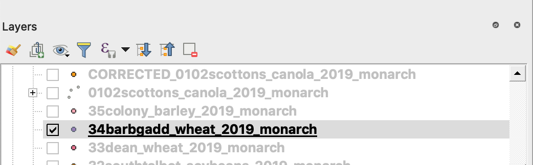
3. Kaydetme işlemini başlatın
4. 1. Sağ tıklayın ve shapefile’a tıklayın
2. Dışa Aktar -> Özelliği Farklı Kaydet ... seçin
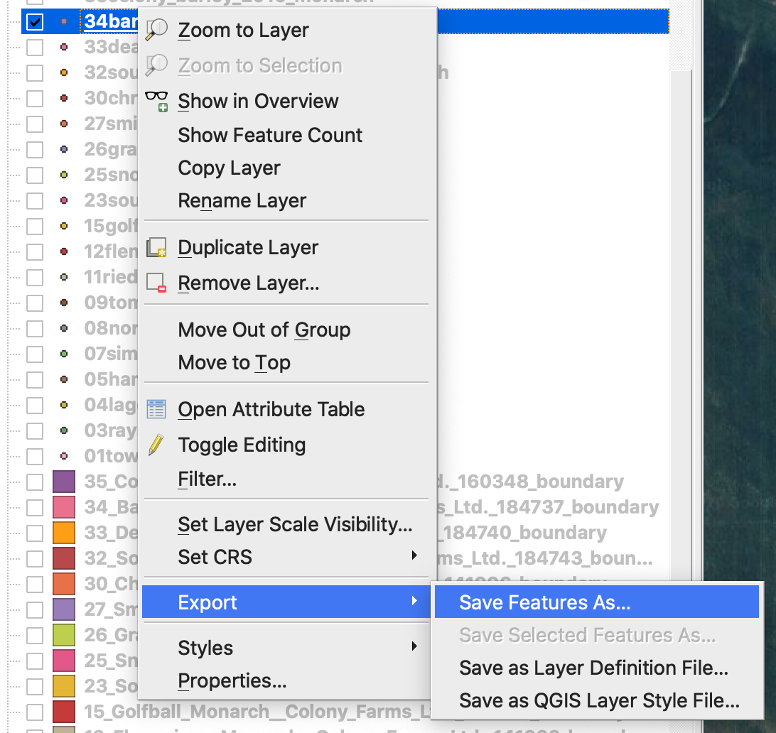
4. Seçin
5. 1. Biçim -> ESRI Shapefile,
2. Dosya adı -> … düğmesine tıklayın ve tercih edilen klasörü ve dosya adını seçin,
3. KOÇAN SİSTEMİ -> EPSG:4326
4. Kodlama -> UTF8
5. Kaydedilen dosyayı haritaya ekle (QGIS’te doğrudan görmek istiyorsanız isteğe bağlı)
6. Geometri türü -> Nokta
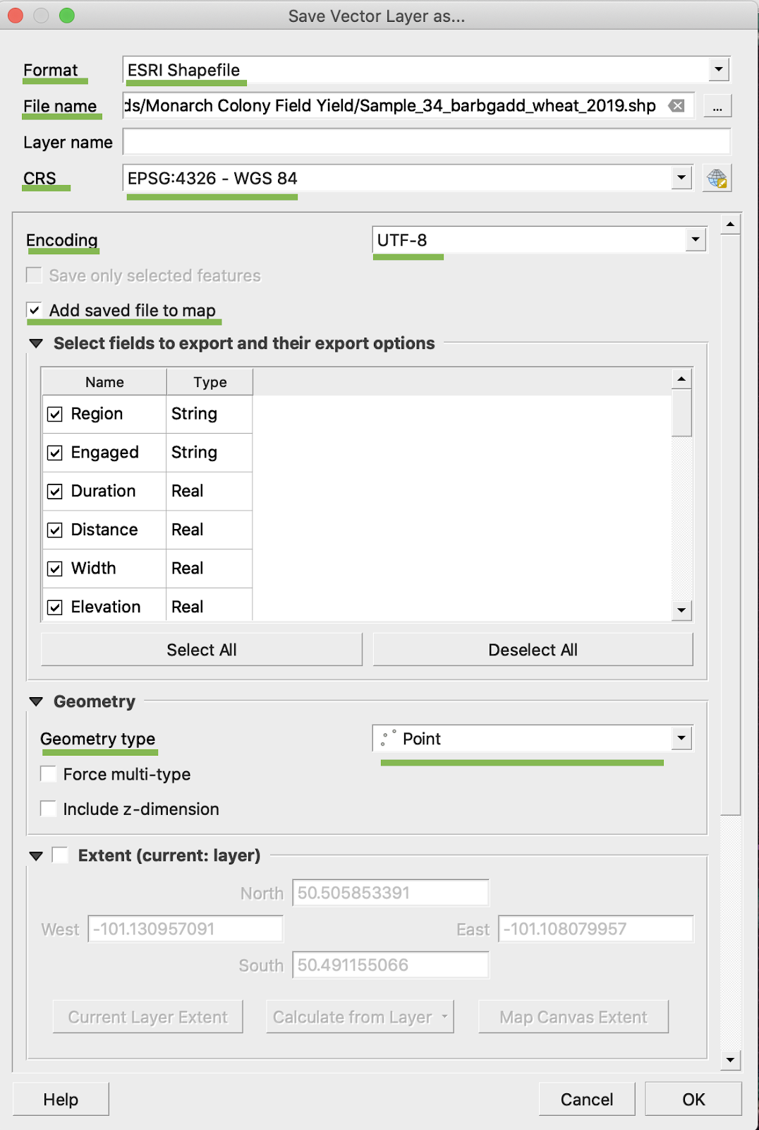
5. Tamam’a tıklayın
6. Aynı verim verilerine sahip ek bir shapefile oluşturulur. Projeksiyon dosyası (.prj) eklendi.
\
### BU/AC DÖNÜŞÜMÜ
1. İlgili shapefile’a sağ tıklayın ve Öznitelik Tablosunu Aç seçeneğini seçin
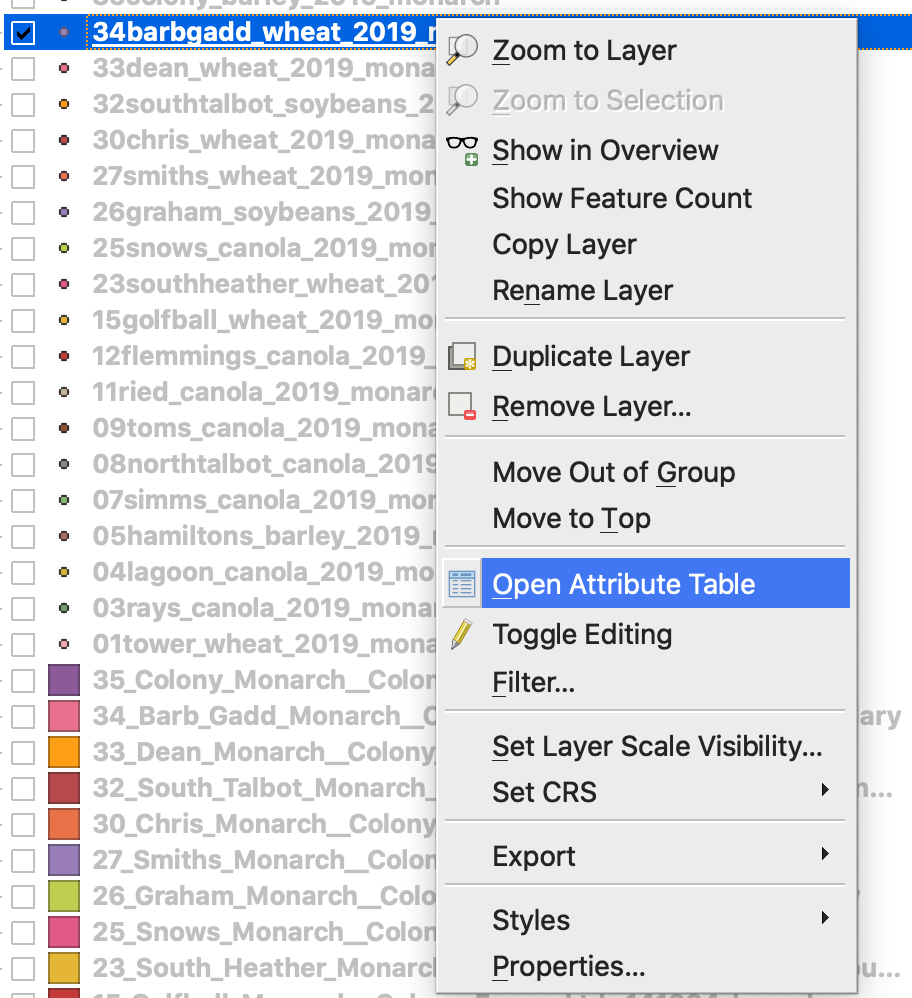
2. Alan Hesaplayıcısını Aç’a tıklayın
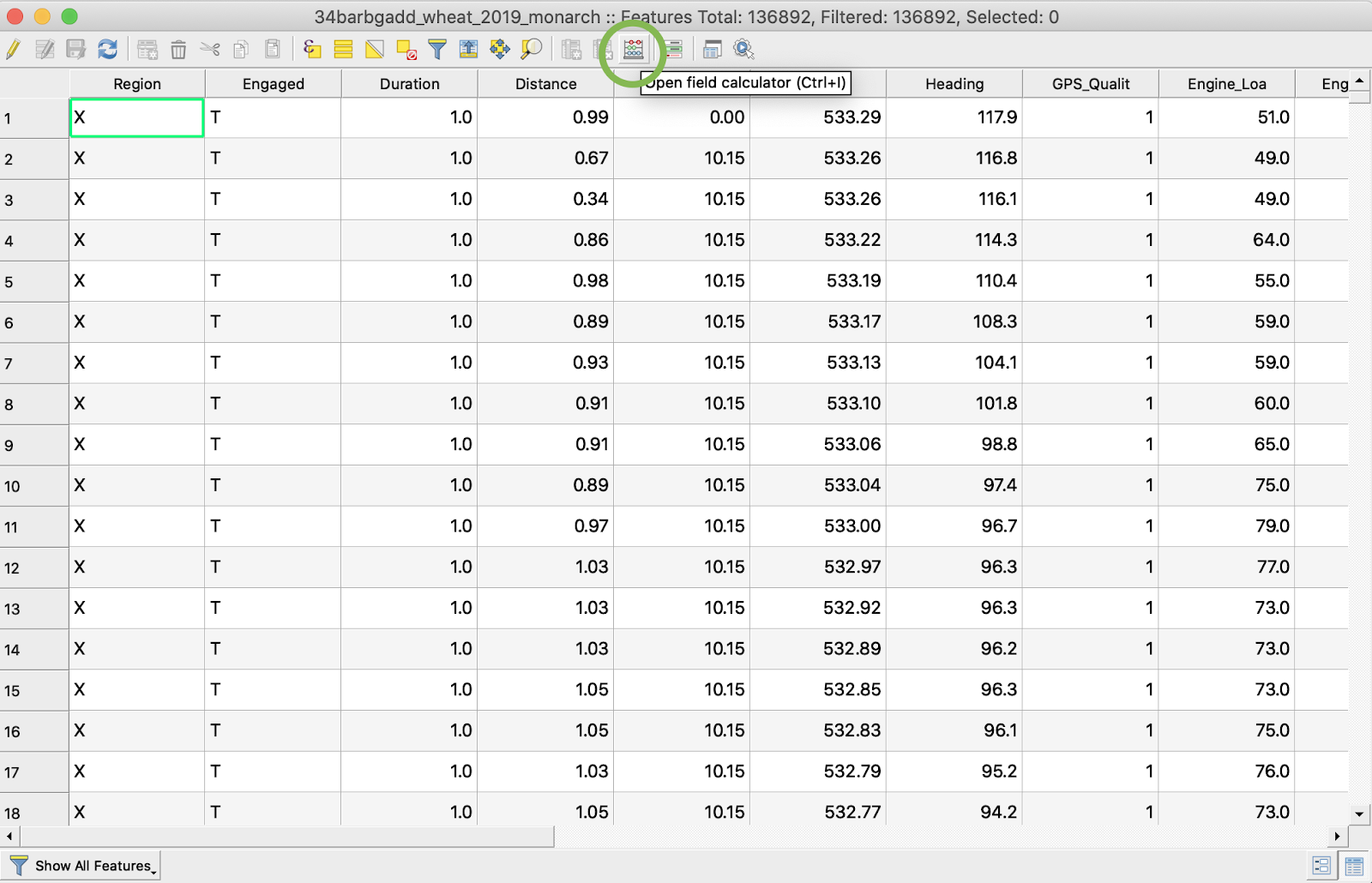
3. Yeni bir alan oluşturun
4. 1. Yeni alan oluştur’u işaretleyin
2. Çıkış alan adı -> DryYieldBu girin
3. Çıkış alan türü -> Ondalıklı sayı (gerçek) seçin
4. Hassasiyet -> 4 olarak değiştirin
5. kg/ha’dan bu/ac’a dönüştürme kuralını girin -> "Dry\_Yield" \* 0.0149
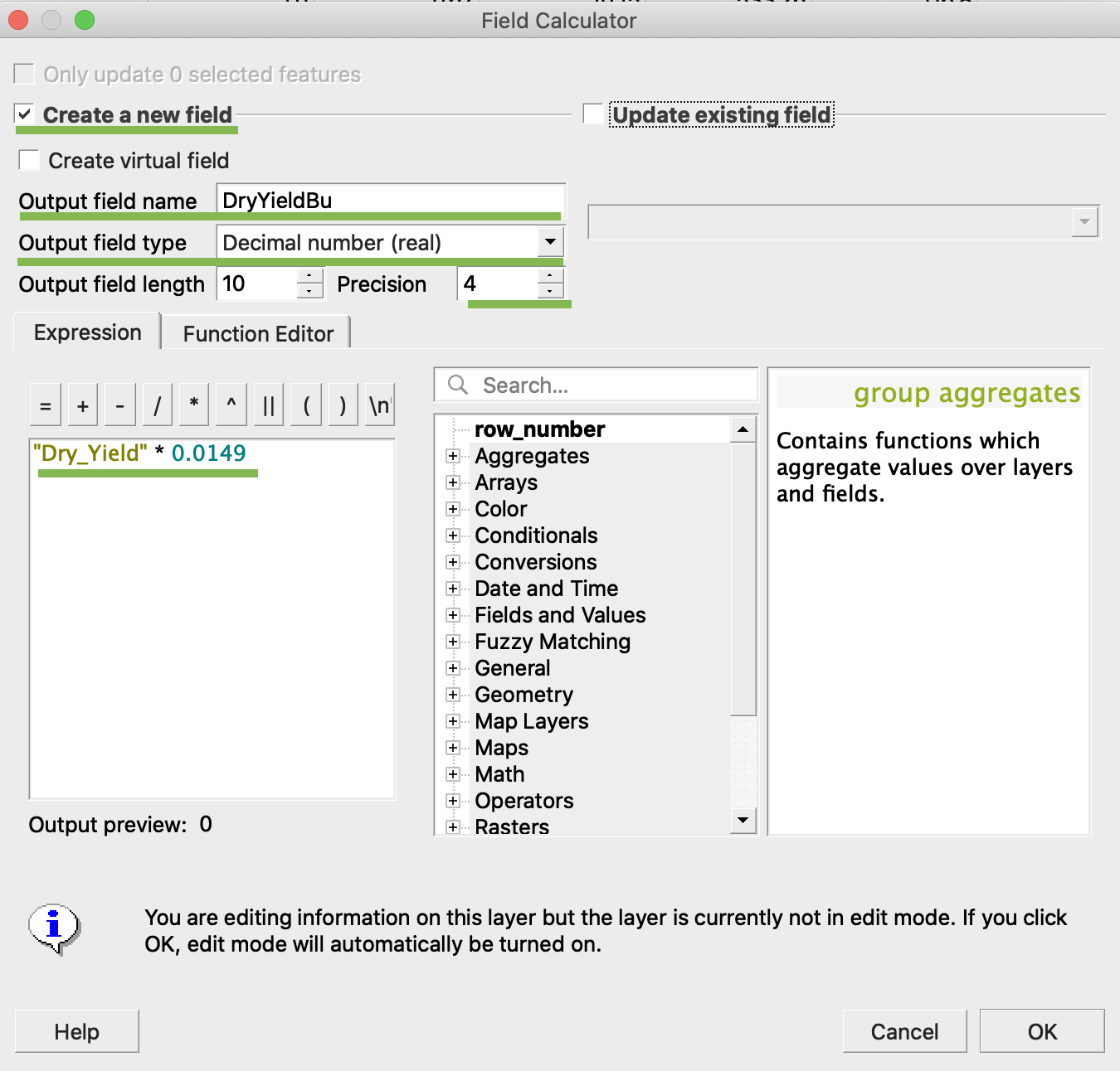
4. Tamam’a tıklayın
5. Tabloda ek DryYieldBu özniteliği görünmüştür
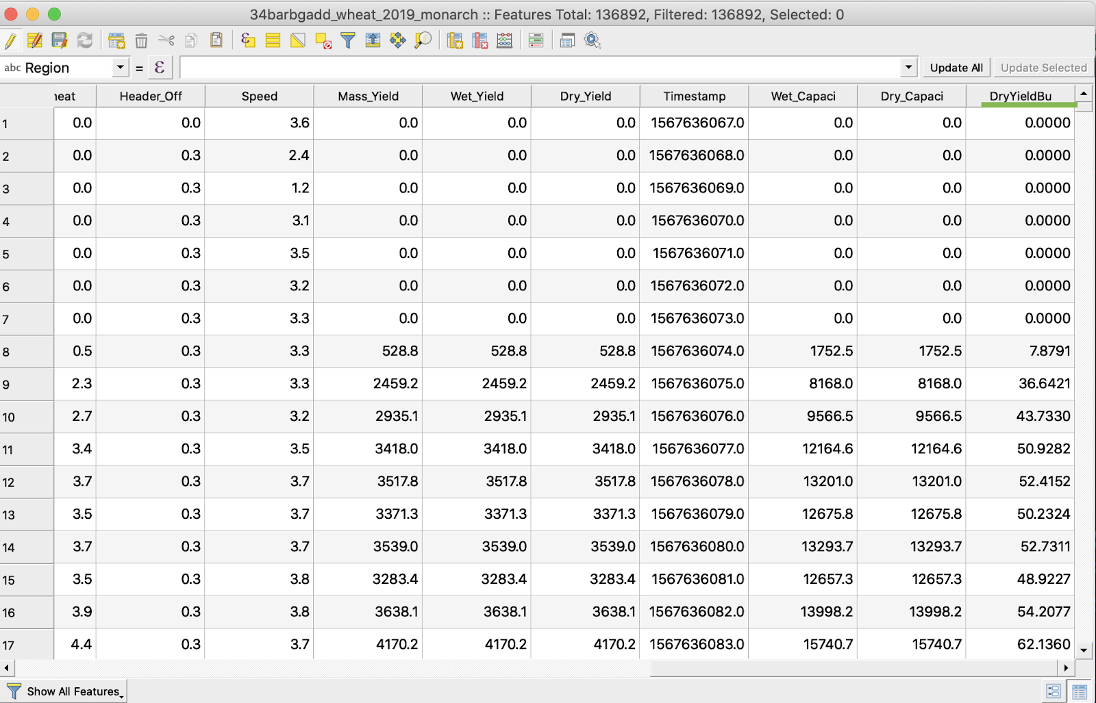
6. Değişiklikleri kaydedin
7. 1. İlgili shapefile’a sağ tıklayın
2. Düzenlemeyi Aç/Kapat seçin
\
\
\
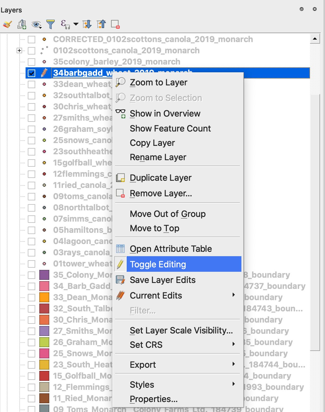
7. Değişikliklerin kaydedilmesini onaylayın
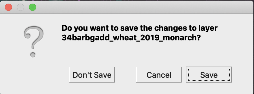
İlgili shapefile artık Kalem ile işaretli değil. Shapefile’daki veriler güncellendi.
---
# Agent Instructions
This documentation is published with GitBook. GitBook is the documentation platform designed so that both humans and AI agents can read, navigate, and reason over technical content effectively. Learn more at gitbook.com.
## Querying This Documentation
If you need additional information that is not directly available in this page, you can query the documentation by asking a question.
Perform an HTTP GET request on the following URL with the `ask` and `goal` query parameters:
```
GET https://docs.geopard.tech/geopard-tutorials/tr/gis-kisa-ipuclari/qgis-verim-verisi-islemleri.md?ask=&goal=
```
`ask` is the immediate question: it should be specific, self-contained, and written in natural language.
`goal` is what the user is ultimately trying to achieve, the reason they need the answer. Sharing it helps GitBook give you a better, more relevant answer. A goal is most helpful when it describes the outcome the user wants rather than restating the question. For example, with `ask=how do I create an API token`, a goal like `automate deployments from our CI pipeline` lets GitBook tailor the answer to that use case.
The response will contain a direct answer to the question and relevant excerpts and sources from the documentation.
Use this mechanism when the answer is not explicitly present in the current page, you need clarification or additional context, or you want to retrieve related documentation sections.