> For the complete documentation index, see [llms.txt](https://docs.geopard.tech/geopard-tutorials/llms.txt). Markdown versions of documentation pages are available by appending `.md` to page URLs; this page is available as [Markdown](https://docs.geopard.tech/geopard-tutorials/swe/snabba-gis-tips/qgis-hantering-av-skordedata.md).
# QGIS: Hantering av skördedata
Förbered och rensa skördedata i QGIS innan du importerar eller analyserar dem i GeoPard.
ÖVERSIKT
Handbok med steg-för-steg-beskrivning för att lösa följande problem med data från skördekarteraren:
1. Saknad projektionsfil (.prj) i shapefilen
2. Tillämpa omräkningsregler för varje attribut i shapefilen (baserat på exempel från kb/ha till bu/ac)
Programmet som ska användas är QGIS ([LÄNK](https://qgis.org/en/site/forusers/download.html)).
Nedladdning och installation är obligatoriskt.
### SAKNAD PROJEKTIONSFIL
1. Öppna shapefilen med skördedata. Dra in filen i QGIS-fönstret.
2. Shapefilen blir tillgänglig för vidare hantering i lagerrutan.
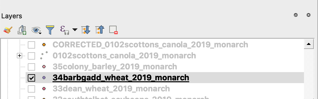
3. Starta sparprocessen
4. 1. Högerklicka på shapefilen
2. Välj Exportera -> Spara objekt som ...
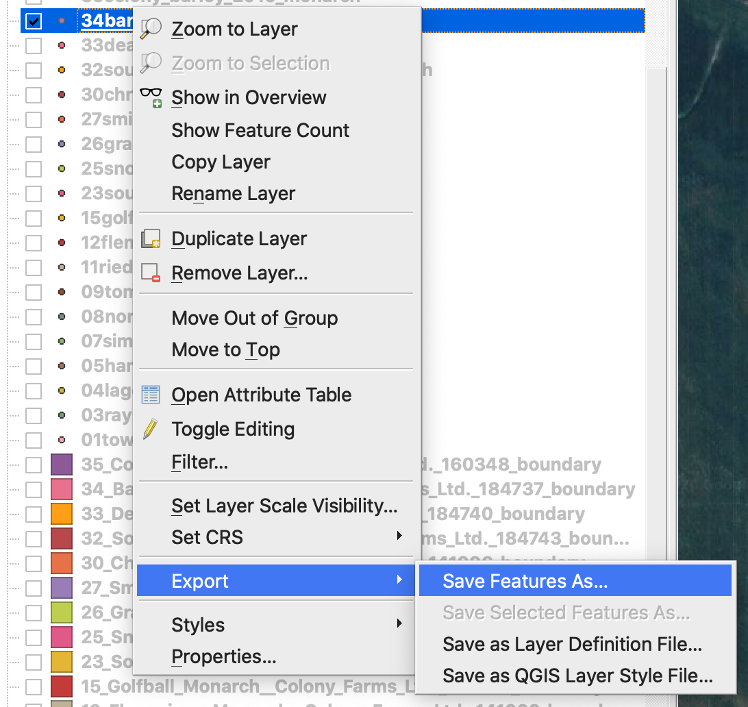
4. Välj
5. 1. Format -> ESRI Shapefile,
2. Filnamn -> klicka på … och välj önskad katalog och filnamn,
3. CRS -> EPSG:4326
4. Kodning -> UTF8
5. Lägg till sparad fil i kartan (valfritt om du vill se den direkt i QGIS)
6. Geometrityp -> Punkt
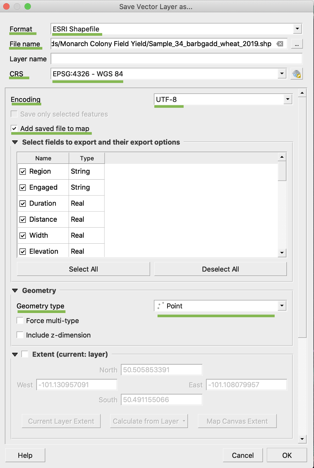
5. Klicka på Ok
6. En extra shapefile med samma skördedata skapas. Projektionsfilen (.prj) har lagts till.
\
### BU/AC-OMRÄKNING
1. Högerklicka på shapefilen och välj Öppna attributtabell
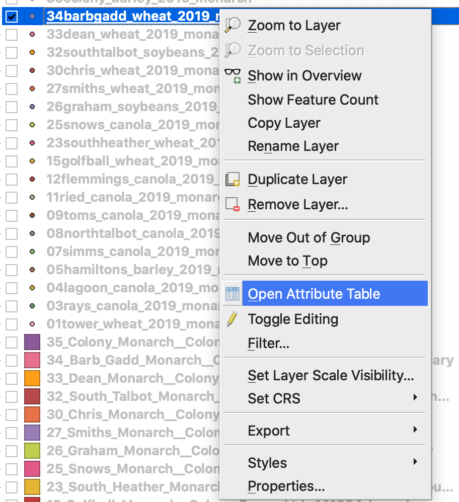
2. Klicka på Öppna fältkalkylatorn
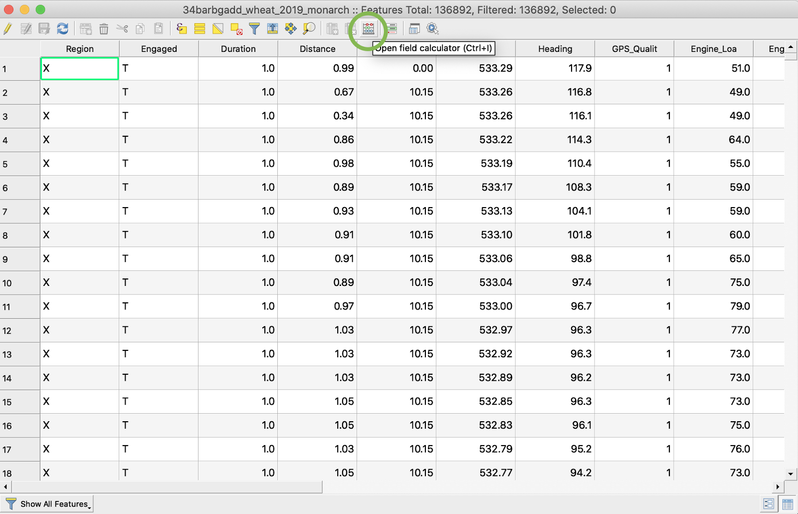
3. Skapa ett nytt fält
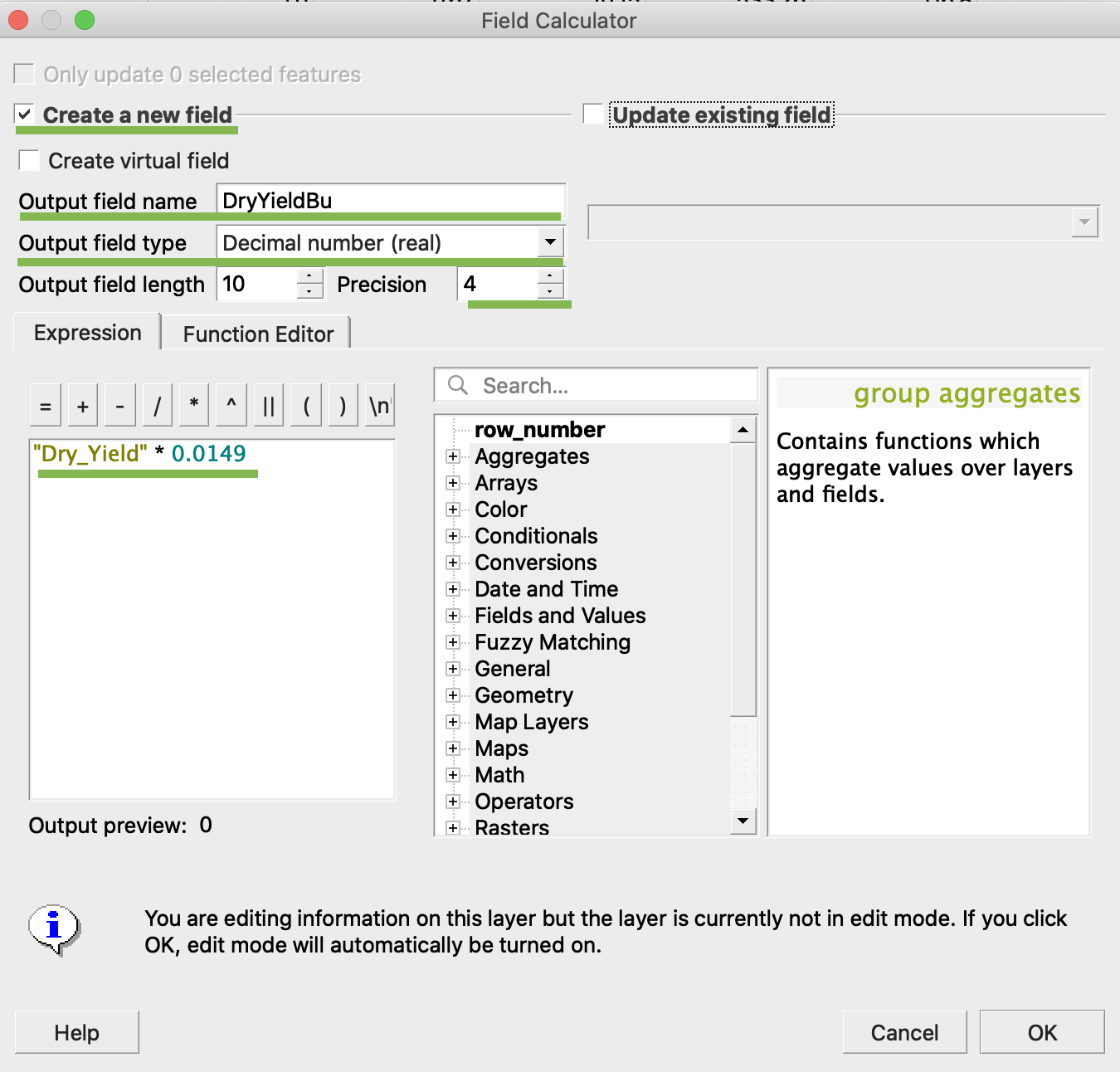
4. 1. Markera Skapa ett nytt fält
2. Ange utdatafältets namn -> DryYieldBu
3. Välj utdatafältstyp -> Decimaltal (reellt)
4. Ändra precision -> 4
5. Lägg in regeln för att omvandla kg/ha till bu/ac -> "Dry\_Yield" \* 0.0149
4. Klicka på Ok
5. Ett extra attribut DryYieldBu har dykt upp i tabellen
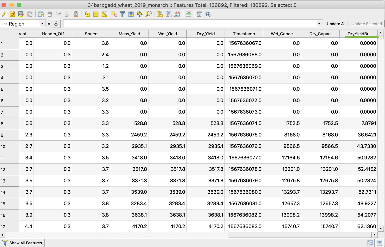
6. Spara ändringarna
7. 1. Högerklicka på den aktuella shapefilen
2. Välj Växla redigering
\
\
\
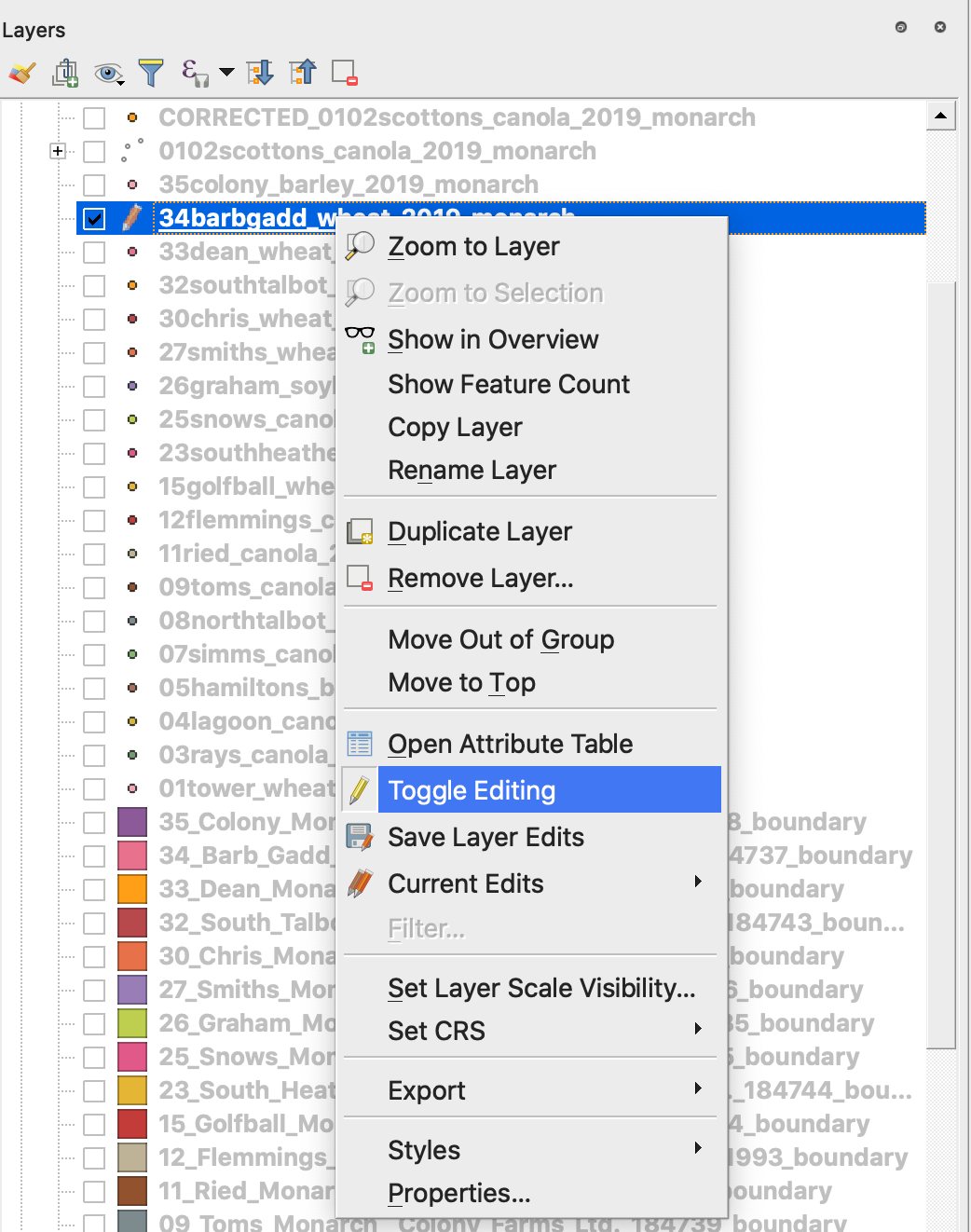
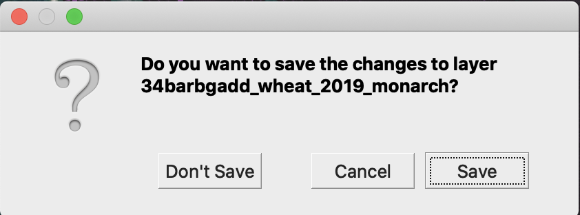
7. Bekräfta att ändringarna ska sparas
Den aktuella shapefilen är inte längre markerad med en penna. Data i shapefilen har uppdaterats.
---
# Agent Instructions
This documentation is published with GitBook. GitBook is the documentation platform designed so that both humans and AI agents can read, navigate, and reason over technical content effectively. Learn more at gitbook.com.
## Querying This Documentation
If you need additional information that is not directly available in this page, you can query the documentation by asking a question.
Perform an HTTP GET request on the following URL with the `ask` and `goal` query parameters:
```
GET https://docs.geopard.tech/geopard-tutorials/swe/snabba-gis-tips/qgis-hantering-av-skordedata.md?ask=&goal=
```
`ask` is the immediate question: it should be specific, self-contained, and written in natural language.
`goal` is what the user is ultimately trying to achieve, the reason they need the answer. Sharing it helps GitBook give you a better, more relevant answer. A goal is most helpful when it describes the outcome the user wants rather than restating the question. For example, with `ask=how do I create an API token`, a goal like `automate deployments from our CI pipeline` lets GitBook tailor the answer to that use case.
The response will contain a direct answer to the question and relevant excerpts and sources from the documentation.
Use this mechanism when the answer is not explicitly present in the current page, you need clarification or additional context, or you want to retrieve related documentation sections.