> For the complete documentation index, see [llms.txt](https://docs.geopard.tech/geopard-tutorials/llms.txt). Markdown versions of documentation pages are available by appending `.md` to page URLs; this page is available as [Markdown](https://docs.geopard.tech/geopard-tutorials/swe/produktvandring-webbapp/zones-maps-and-analytics/create-a-zones-map-using-satellite-imagery.md).
# Skapa en zonkarta med satellitbilder
Bygg skötselzoner från satellitbilder för att fånga variation och styra beslut om variabel giva.
1. Markera fältet i listan och klicka på **Skapa zonkarta** -knappen, välj **Enkelskiktad**, och klicka sedan på **Nästa**.
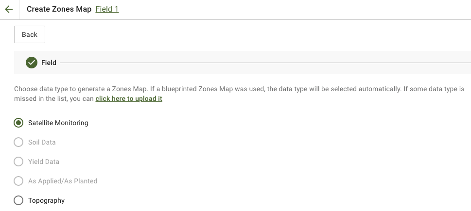
2. Välj **Satellitövervakning** datatyp för att fortsätta.
3. I nästa steg kan du välja en satellitbild. Du kan filtrera efter månad, år, leverantör eller NDVI och växla mellan bildvisningar som NIR och EVI2. **Här är en kort beskrivning av indextyperna** länken beskriver vilka index som finns tillgängliga. Om du vill byta index klickar du på pilen bredvid **EVI2**. Klicka sedan på **Nästa**.
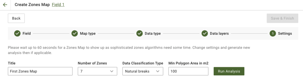
4. I nästa steg kan du redigera titeln, ändra antalet zoner, [välja en klassificeringstyp för data](https://docs.geopard.tech/geopard-tutorials/swe/produktvandring-webbapp/zones-maps-and-analytics/using-data-classification.md), och ange minsta polygonarea i kvadratmeter. Klicka på **Kör analys** för att fortsätta.
Analysen kan ta upp till 60 sekunder, beroende på vilka parametrar du har angett.
5. När den är klar klickar du på **Spara och slutför**.
När den har sparats visas följande meddelande:
Du kan skapa en till zonkarta, tilldela mängder eller öppna zonkartan som du just har skapat. Om du öppnar den visas en liknande vy.
---
# Agent Instructions
This documentation is published with GitBook. GitBook is the documentation platform designed so that both humans and AI agents can read, navigate, and reason over technical content effectively. Learn more at gitbook.com.
## Querying This Documentation
If you need additional information that is not directly available in this page, you can query the documentation by asking a question.
Perform an HTTP GET request on the following URL with the `ask` and `goal` query parameters:
```
GET https://docs.geopard.tech/geopard-tutorials/swe/produktvandring-webbapp/zones-maps-and-analytics/create-a-zones-map-using-satellite-imagery.md?ask=&goal=
```
`ask` is the immediate question: it should be specific, self-contained, and written in natural language.
`goal` is what the user is ultimately trying to achieve, the reason they need the answer. Sharing it helps GitBook give you a better, more relevant answer. A goal is most helpful when it describes the outcome the user wants rather than restating the question. For example, with `ask=how do I create an API token`, a goal like `automate deployments from our CI pipeline` lets GitBook tailor the answer to that use case.
The response will contain a direct answer to the question and relevant excerpts and sources from the documentation.
Use this mechanism when the answer is not explicitly present in the current page, you need clarification or additional context, or you want to retrieve related documentation sections.