> For the complete documentation index, see [llms.txt](https://docs.geopard.tech/geopard-tutorials/llms.txt). Markdown versions of documentation pages are available by appending `.md` to page URLs; this page is available as [Markdown](https://docs.geopard.tech/geopard-tutorials/svn/hitri-gis-namigi/qgis-yield-data-manipulations.md).
# QGIS: obdelava podatkov o pridelku
Pripravite in očistite podatke o pridelku v QGIS, preden jih uvozite ali analizirate v GeoPard.
PREGLED
Navodila po korakih za odpravljanje naslednjih težav s podatki iz monitorja donosa:
1. V datoteki shapefile manjka datoteka projekcije (.prj)
2. Uporaba pravil za pretvorbo vseh atributov v datoteki shapefile (na podlagi primera pretvorbe iz kb/ha v bu/ac)
Uporabite programsko opremo QGIS ([POVEZAVA](https://qgis.org/en/site/forusers/download.html)).
Prenos in namestitev sta obvezna.
### MANJKA DATOTEKA PROJEKCIJE
1. Odprite datoteko shapefile s podatki o donosu. Povlecite datoteko v okno QGIS.
2. Datoteka shapefile je na voljo za nadaljnje urejanje v podoknu Plasti.
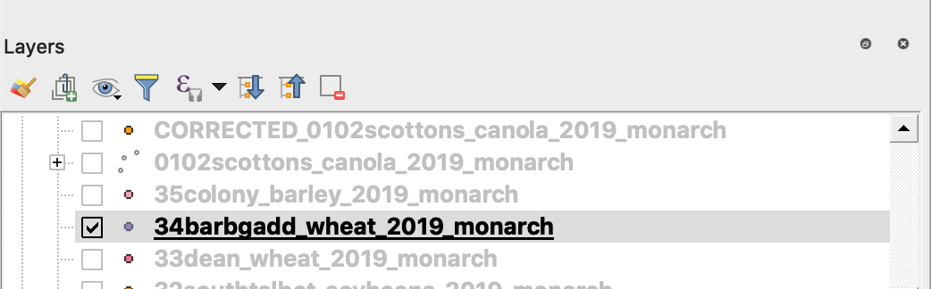
3. Začnite postopek shranjevanja
4. 1. Z desno tipko miške kliknite datoteko shapefile
2. Izberite Izvoz -> Shrani elemente kot ...
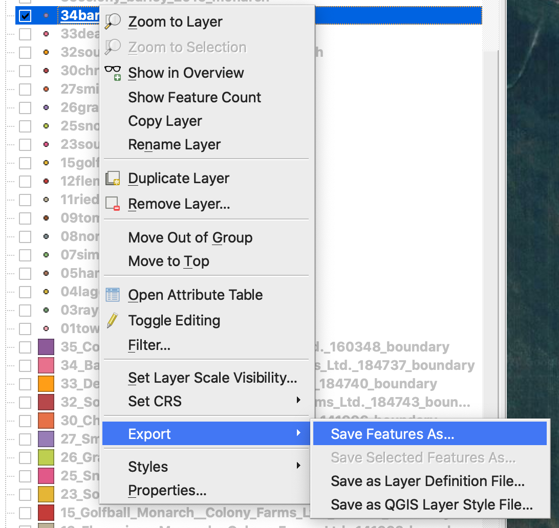
4. Izberite
5. 1. Format -> ESRI Shapefile,
2. Ime datoteke -> kliknite … ter izberite želeno mapo in ime datoteke,
3. CRS -> EPSG:4326
4. Kodiranje -> UTF8
5. Dodaj shranjeno datoteko na zemljevid (izbirno, če jo želite takoj videti v QGIS)
6. Vrsta geometrije -> Točka
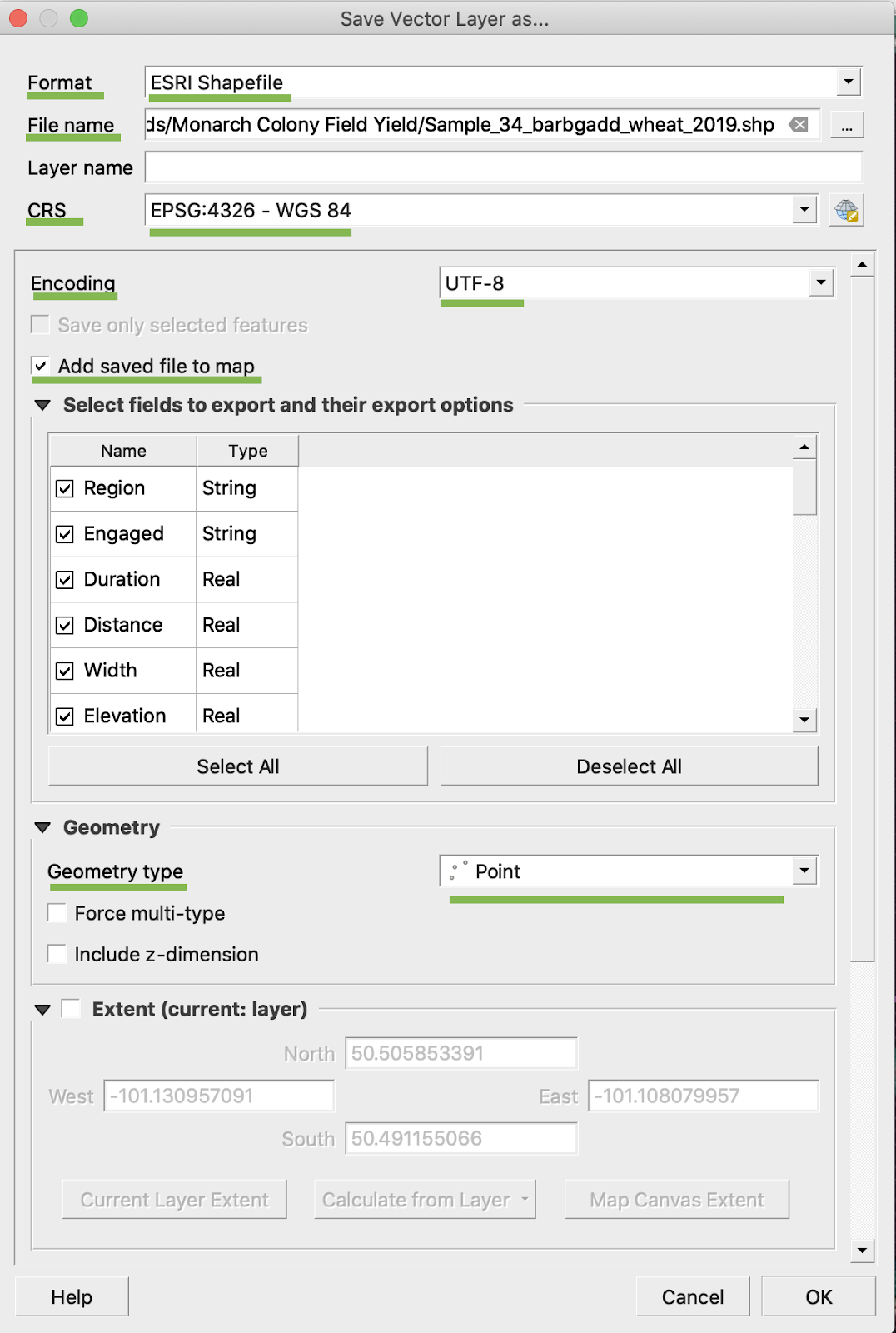
5. Kliknite V redu
6. Ustvari se dodatna datoteka shapefile z enakimi podatki o donosu. Dodana je bila datoteka projekcije (.prj).
\
### PRETVORBA BU/AC
1. Z desno tipko miške kliknite datoteko shapefile in izberite Odpri atributno tabelo
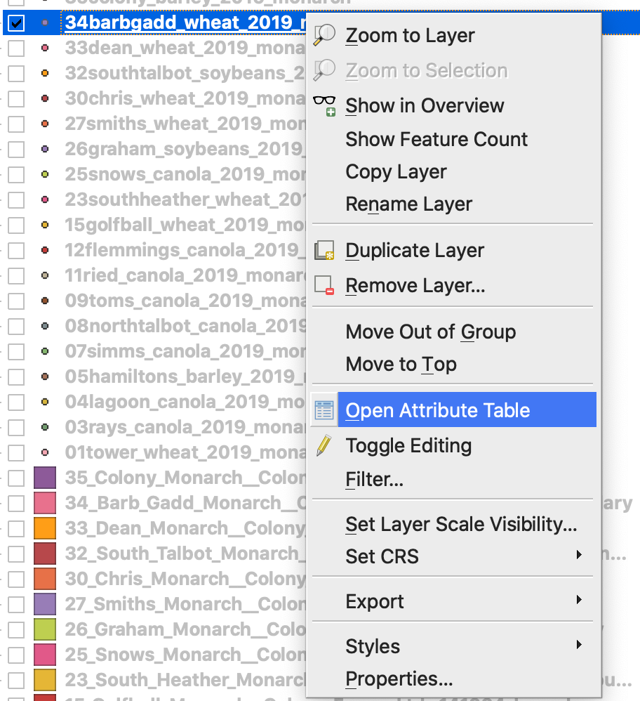
2. Kliknite Odpri kalkulator polj
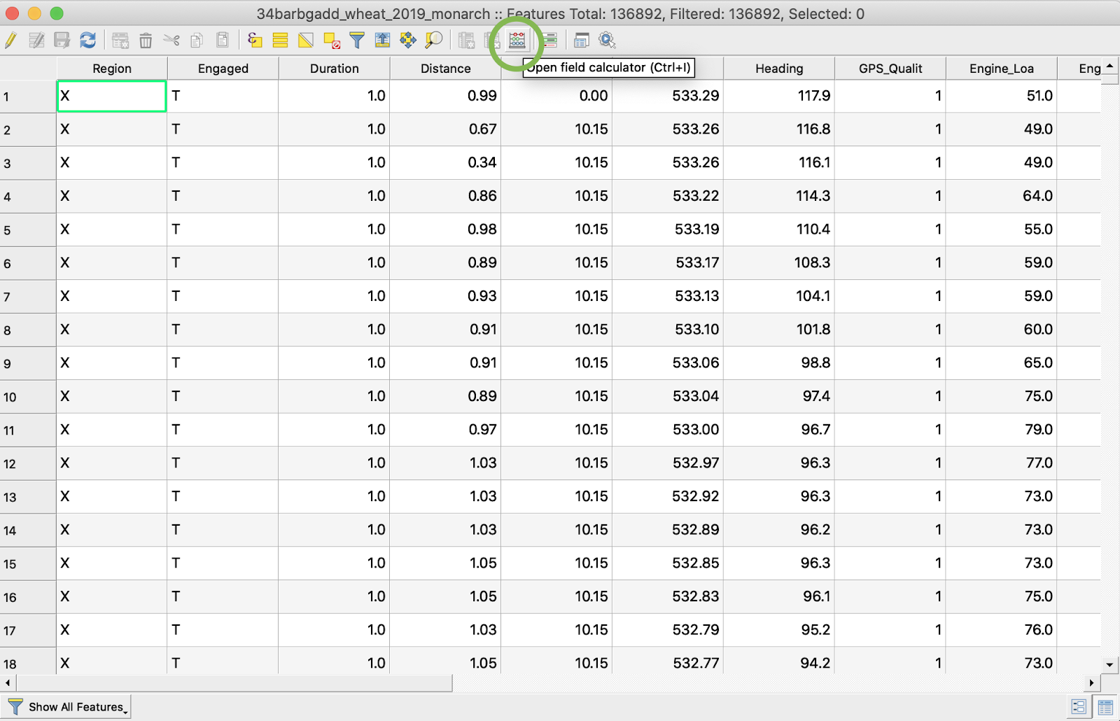
3. Ustvarite novo polje
4. 1. Označite Ustvari novo polje
2. Vnesite Ime izhodnega polja -> DryYieldBu
3. Izberite Vrsto izhodnega polja -> Decimalno število (realno)
4. Spremenite Natančnost -> 4
5. Vnesite pravilo za pretvorbo iz kg/ha v bu/ac -> "Dry\_Yield" \* 0.0149
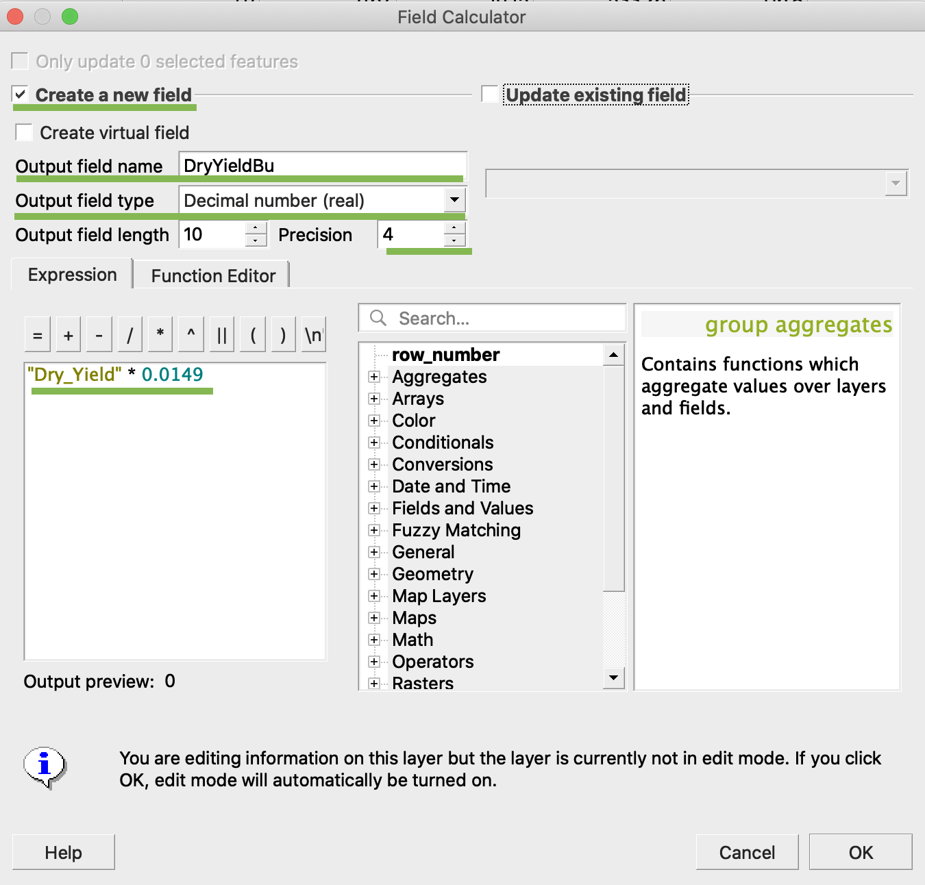
4. Kliknite V redu
5. V tabeli se je pojavil dodaten atribut DryYieldBu
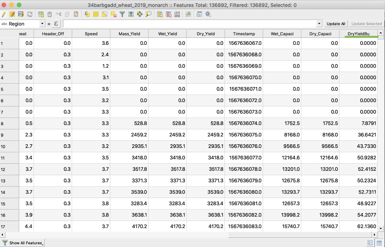
6. Shranite spremembe
7. 1. Z desno tipko miške kliknite želeno datoteko shapefile
2. Izberite Preklopi urejanje
\
\
\
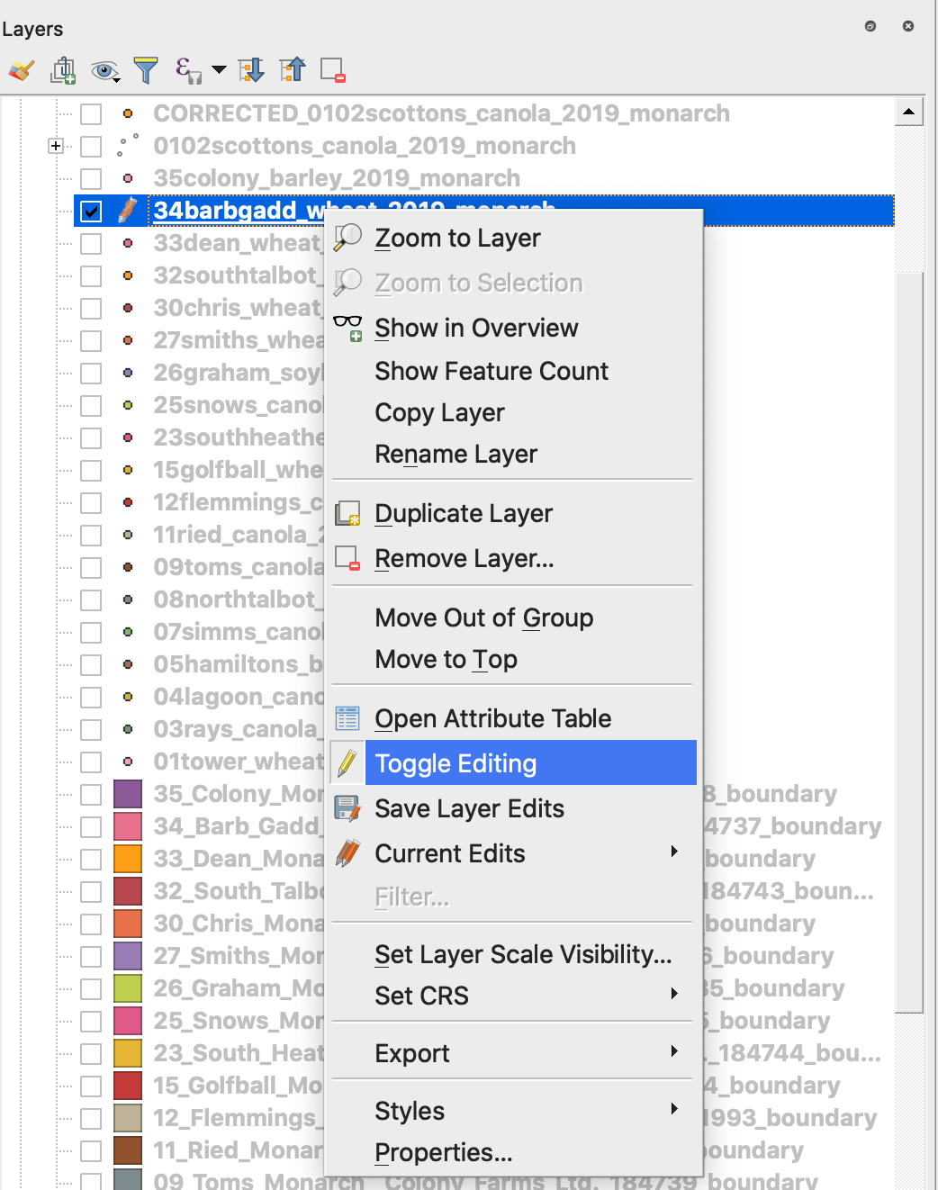
7. Potrdite shranjevanje sprememb
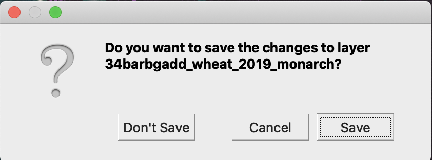
Želena datoteka shapefile ni več označena s svinčnikom. Podatki v datoteki shapefile so bili posodobljeni.
---
# Agent Instructions
This documentation is published with GitBook. GitBook is the documentation platform designed so that both humans and AI agents can read, navigate, and reason over technical content effectively. Learn more at gitbook.com.
## Querying This Documentation
If you need additional information that is not directly available in this page, you can query the documentation by asking a question.
Perform an HTTP GET request on the following URL with the `ask` and `goal` query parameters:
```
GET https://docs.geopard.tech/geopard-tutorials/svn/hitri-gis-namigi/qgis-yield-data-manipulations.md?ask=&goal=
```
`ask` is the immediate question: it should be specific, self-contained, and written in natural language.
`goal` is what the user is ultimately trying to achieve, the reason they need the answer. Sharing it helps GitBook give you a better, more relevant answer. A goal is most helpful when it describes the outcome the user wants rather than restating the question. For example, with `ask=how do I create an API token`, a goal like `automate deployments from our CI pipeline` lets GitBook tailor the answer to that use case.
The response will contain a direct answer to the question and relevant excerpts and sources from the documentation.
Use this mechanism when the answer is not explicitly present in the current page, you need clarification or additional context, or you want to retrieve related documentation sections.