> For the complete documentation index, see [llms.txt](https://docs.geopard.tech/geopard-tutorials/llms.txt). Markdown versions of documentation pages are available by appending `.md` to page URLs; this page is available as [Markdown](https://docs.geopard.tech/geopard-tutorials/ro/sfaturi-rapide-gis/qgis-calculati-ndvi-pentru-fisierul-geotiff-al-dronei.md).
# QGIS: Calculați NDVI pentru fișierul Geotiff al dronei
Uneori trebuie să calculați NDVI-ul mediu pentru un anumit poligon din interiorul parcelei. Puteți face următoarele într-un program QGIS.
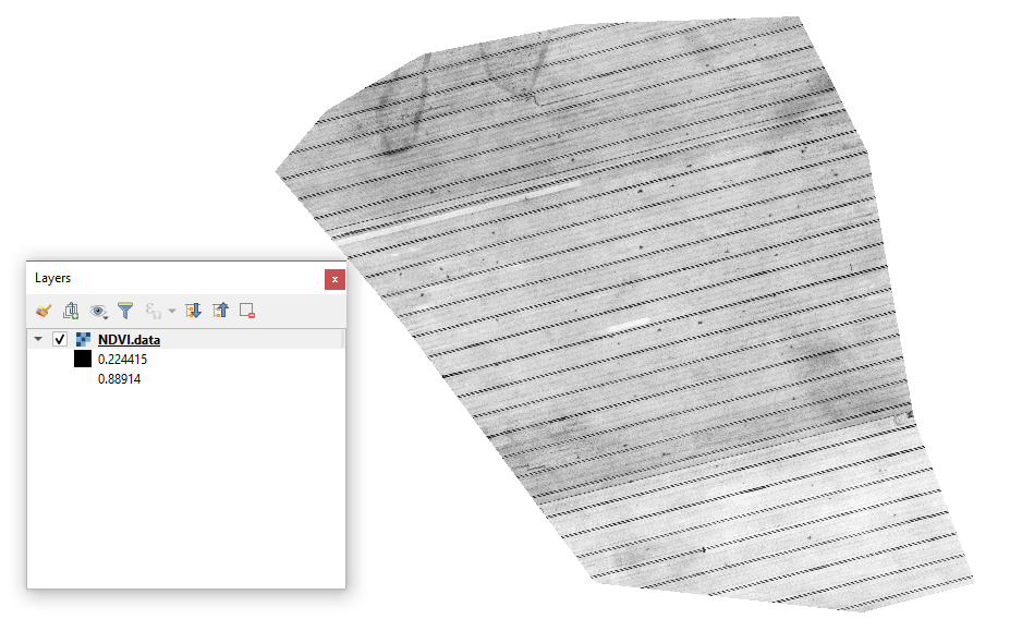
#### 1 - Vizualizați GeoTIFF-ul NDVI inițial de la dronă
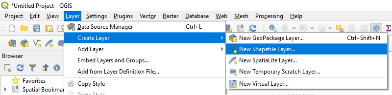
#### 2 - Creați un strat nou
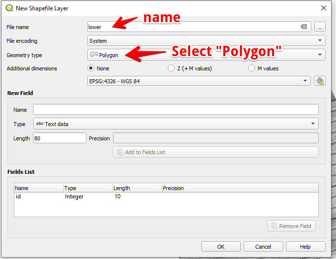
#### 3 - Configurați numele stratului și tipul de geometrie, apoi apăsați OK
#### 4 - Selectați stratul în panoul Straturi
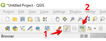
1. Selectați „Comutare editare” (1)
2. Selectați „Adăugare entitate poligonală” (2)
#### 5 - Desenați un poligon. Pentru a termina desenarea, apăsați butonul din dreapta al mouse-ului și setați „id” în fereastra pop-up.
Finalizați stratul apăsând din nou „Comutare editare” și apăsați „Salvare”.
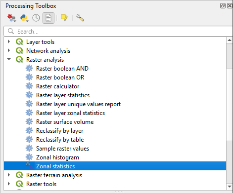
#### 6 - Selectați statistici zonale în panoul „Processing toolbox”.
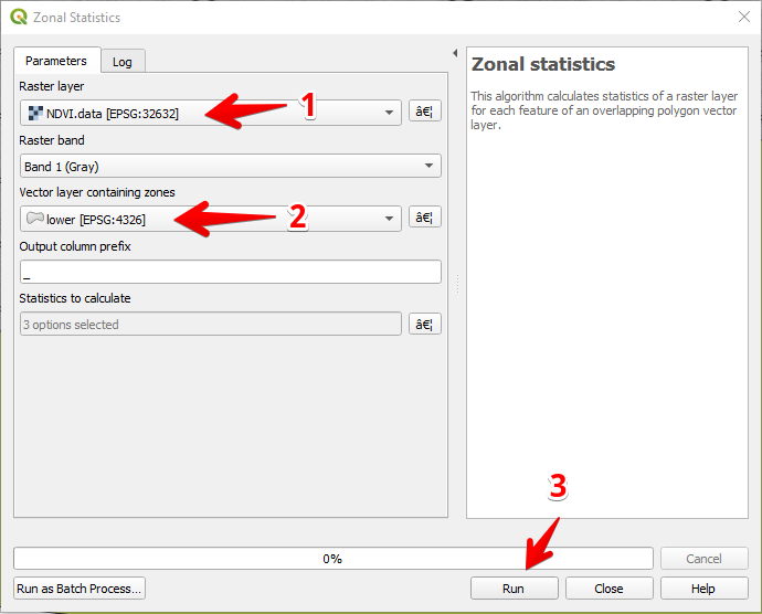
#### 7 - Selectați stratul raster (1),
Selectați stratul poligonal (2),
Apăsați „Run” (3).
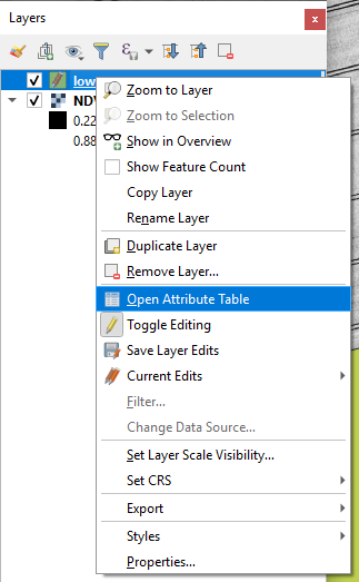
#### 8 - Selectați stratul în panoul Straturi și apăsați butonul din dreapta al mouse-ului; în meniul contextual selectați Deschide tabela de atribute.
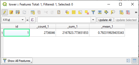
#### 9 - Statisticile calculate vor fi afișate în tabel.
---
# Agent Instructions
This documentation is published with GitBook. GitBook is the documentation platform designed so that both humans and AI agents can read, navigate, and reason over technical content effectively. Learn more at gitbook.com.
## Querying This Documentation
If you need additional information that is not directly available in this page, you can query the documentation dynamically by asking a question.
Perform an HTTP GET request on the current page URL with the `ask` query parameter, and the optional `goal` query parameter:
```
GET https://docs.geopard.tech/geopard-tutorials/ro/sfaturi-rapide-gis/qgis-calculati-ndvi-pentru-fisierul-geotiff-al-dronei.md?ask=&goal=
```
`ask` is the immediate question: it should be specific, self-contained, and written in natural language.
`goal` is optional and describes the broader end goal you are ultimately trying to accomplish on behalf of the user. GitBook uses it to tailor the answer towards what is most useful for that goal.
The response will contain a direct answer to the question and relevant excerpts and sources from the documentation.
Use this mechanism when the answer is not explicitly present in the current page, you need clarification or additional context, or you want to retrieve related documentation sections.