> For the complete documentation index, see [llms.txt](https://docs.geopard.tech/geopard-tutorials/llms.txt). Markdown versions of documentation pages are available by appending `.md` to page URLs; this page is available as [Markdown](https://docs.geopard.tech/geopard-tutorials/pt-br/dicas-rapidas-de-gis/qgis-calcular-ndvi-para-o-arquivo-geotiff-do-drone.md).
# QGIS: Calcular NDVI para o arquivo GeoTIFF do drone
Às vezes, você precisa calcular o NDVI médio para algum polígono dentro da lavoura. Você pode fazer o seguinte em um programa QGIS.
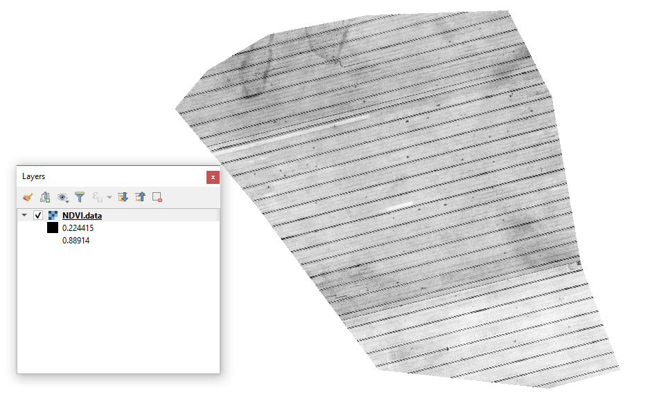
#### 1 - Visualize o geotiff do NDVI inicial do drone
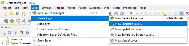
#### 2 - Crie uma nova camada
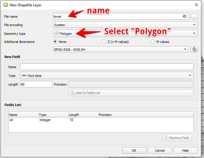
#### 3 - Configure o nome da camada e o tipo de geometria e pressione OK
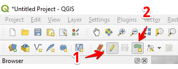
#### 4 - Selecione a camada no painel Camadas
1. Selecione “Alternar edição” (1)
2. Selecione “Adicionar feição poligonal” (2)
#### 5 - Desenhe um polígono. Para finalizar o desenho, pressione o botão direito do mouse e defina “id” na janela pop-up.
Finalize a camada pressionando “Alternar edição” novamente e depois “Salvar”.
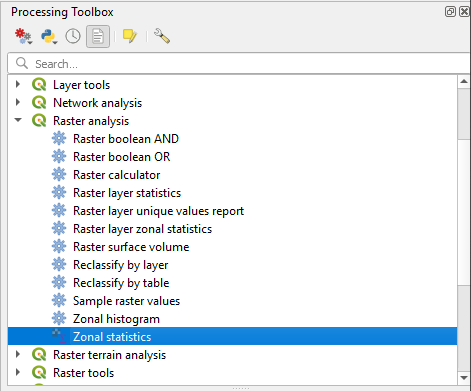
#### 6 - Selecione Estatísticas zonais no painel “Caixa de ferramentas de processamento”.
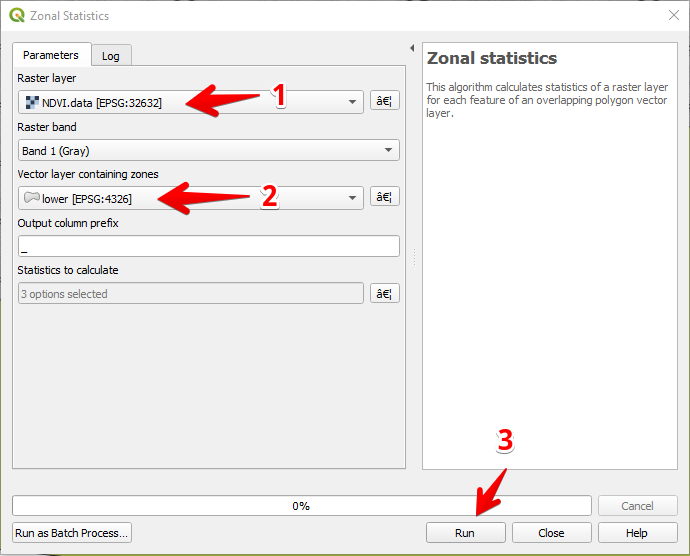
#### 7 - Selecione a camada raster (1),
Selecione a camada de polígonos (2),
Pressione “Executar” (3).
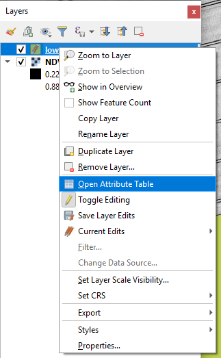
#### 8 - Selecione a camada no painel Camadas e pressione o botão direito do mouse; no menu de contexto, selecione Abrir tabela de atributos.
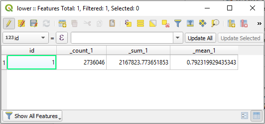
#### 9 - As estatísticas calculadas serão mostradas na tabela.
---
# Agent Instructions
This documentation is published with GitBook. GitBook is the documentation platform designed so that both humans and AI agents can read, navigate, and reason over technical content effectively. Learn more at gitbook.com.
## Querying This Documentation
If you need additional information that is not directly available in this page, you can query the documentation by asking a question.
Perform an HTTP GET request on the following URL with the `ask` and `goal` query parameters:
```
GET https://docs.geopard.tech/geopard-tutorials/pt-br/dicas-rapidas-de-gis/qgis-calcular-ndvi-para-o-arquivo-geotiff-do-drone.md?ask=&goal=
```
`ask` is the immediate question: it should be specific, self-contained, and written in natural language.
`goal` is what the user is ultimately trying to achieve, the reason they need the answer. Sharing it helps GitBook give you a better, more relevant answer. A goal is most helpful when it describes the outcome the user wants rather than restating the question. For example, with `ask=how do I create an API token`, a goal like `automate deployments from our CI pipeline` lets GitBook tailor the answer to that use case.
The response will contain a direct answer to the question and relevant excerpts and sources from the documentation.
Use this mechanism when the answer is not explicitly present in the current page, you need clarification or additional context, or you want to retrieve related documentation sections.