> For the complete documentation index, see [llms.txt](https://docs.geopard.tech/geopard-tutorials/llms.txt). Markdown versions of documentation pages are available by appending `.md` to page URLs; this page is available as [Markdown](https://docs.geopard.tech/geopard-tutorials/nl/snelle-gis-tips/qgis-csv-naar-shp-converteren.md).
# QGIS: CSV naar SHP converteren
Converteer CSV-puntgegevens in QGIS naar een shapefile voor import in GeoPard en GIS-gebruik.
De handleiding helpt om CSV om te zetten naar SHP (shapefile). Hieronder staan stappen om dit te doen met [QGIS](https://www.qgis.org/en/site/) desktopsoftware.
**BELANGRIJK**: De gegevens in CSV-formaat moeten `lengtegraad` en `breedtegraad` kolommen bevatten om de juiste georeferentiekoppeling te maken.
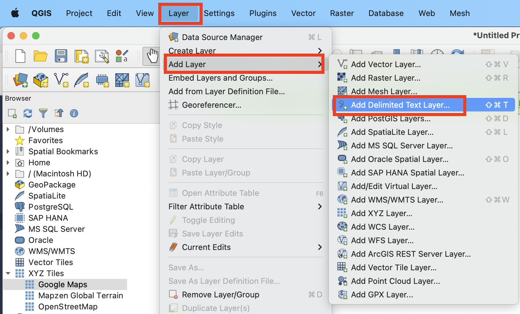
**STAP 1**: Start het importproces via "Laag" >> "Laag toevoegen" >> "Afgebakende tekstlaag toevoegen".
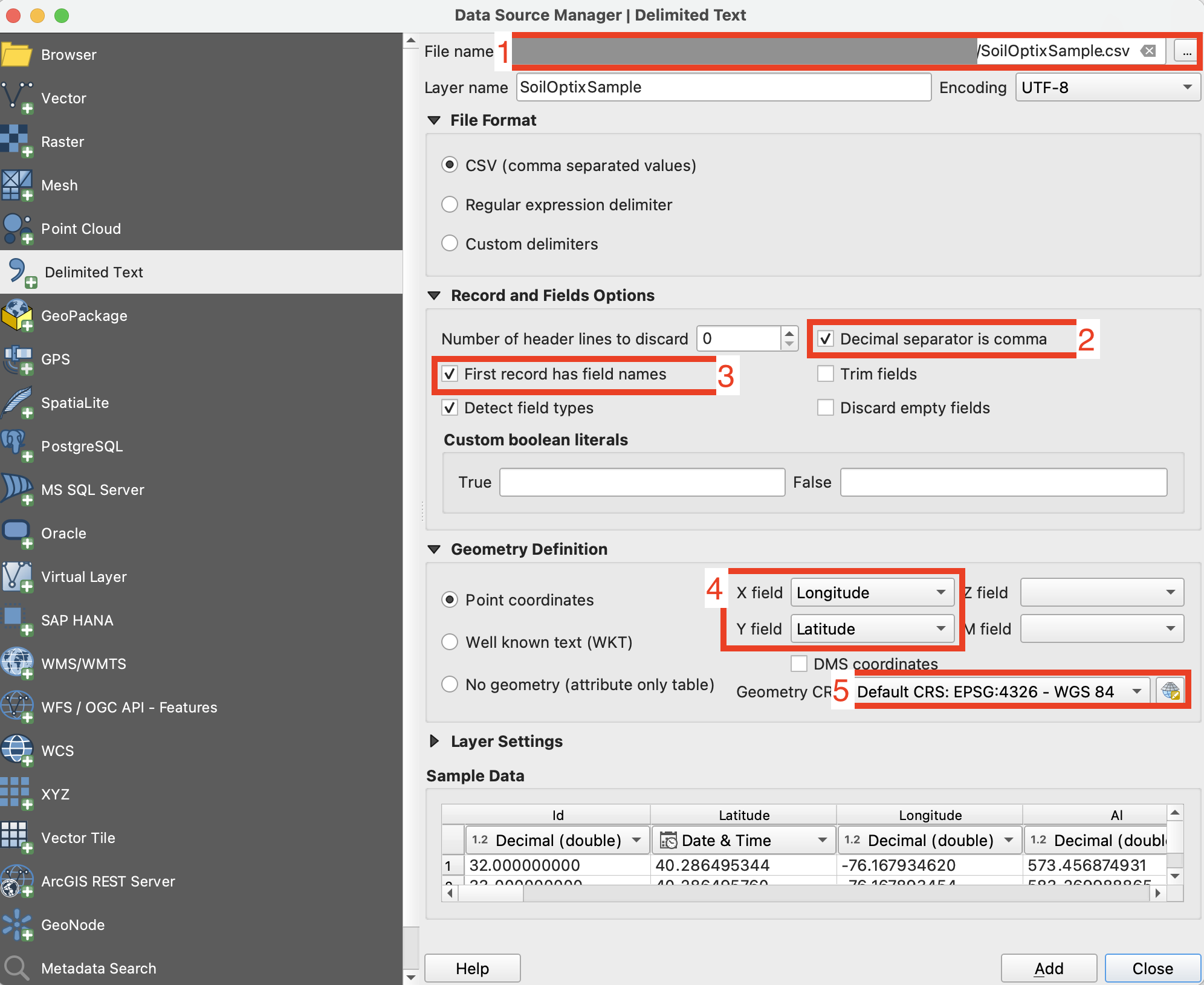
**STAP 2**: Stel de importparameters in en klik op de knop "Toevoegen".
1. Geef het pad naar het CSV-bestand op
2. Controleer de kolomscheidingsteken, dit moet een komma zijn.
3. Controleer de eerste rij. Meestal bevat deze de namen van de attributen. Deze moet worden uitgesloten van de parsing.
4. Selecteer de datasetkolommen met gegevens voor Breedtegraad (X) en Lengtegraad (Y).
5. Stel het coördinatenreferentiesysteem in. Meestal wordt ESPG:4326 gebruikt.
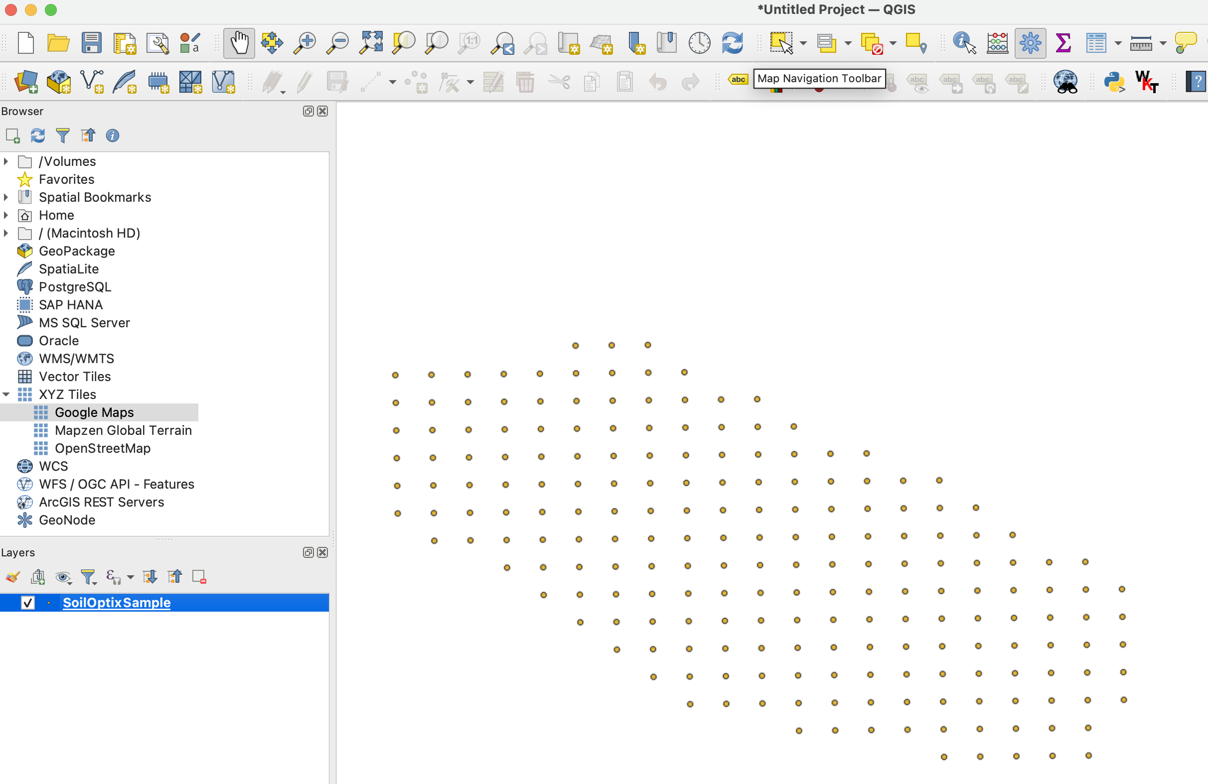
Het verwachte resultaat na **STAP 2** ziet eruit als
**STAP 3**: Start de exportstroom via een klik met de "rechter muisknop" >> "Exporteren" >> "Opslaan als objecten..."
**STAP 4**: Stel de juiste exportopties in en klik op "Ok".
1. Stel het pad voor het geëxporteerde shapefile in.
2. Stel het coördinatenreferentiesysteem (CRS) in op ESPG:4326, wat wordt geaccepteerd door GeoPard.
---
# Agent Instructions
This documentation is published with GitBook. GitBook is the documentation platform designed so that both humans and AI agents can read, navigate, and reason over technical content effectively. Learn more at gitbook.com.
## Querying This Documentation
If you need additional information that is not directly available in this page, you can query the documentation by asking a question.
Perform an HTTP GET request on the following URL with the `ask` and `goal` query parameters:
```
GET https://docs.geopard.tech/geopard-tutorials/nl/snelle-gis-tips/qgis-csv-naar-shp-converteren.md?ask=&goal=
```
`ask` is the immediate question: it should be specific, self-contained, and written in natural language.
`goal` is what the user is ultimately trying to achieve, the reason they need the answer. Sharing it helps GitBook give you a better, more relevant answer. A goal is most helpful when it describes the outcome the user wants rather than restating the question. For example, with `ask=how do I create an API token`, a goal like `automate deployments from our CI pipeline` lets GitBook tailor the answer to that use case.
The response will contain a direct answer to the question and relevant excerpts and sources from the documentation.
Use this mechanism when the answer is not explicitly present in the current page, you need clarification or additional context, or you want to retrieve related documentation sections.