> For the complete documentation index, see [llms.txt](https://docs.geopard.tech/geopard-tutorials/llms.txt). Markdown versions of documentation pages are available by appending `.md` to page URLs; this page is available as [Markdown](https://docs.geopard.tech/geopard-tutorials/lva/gis-atrie-padomi/qgis-yield-data-manipulations.md).
# QGIS: ražības datu apstrāde
Sagatavojiet un notīriet ražības datus QGIS pirms to importēšanas vai analīzes GeoPard.
PĀRSKATS
Soli pa solim izstrādāta pamācība, kā novērst tālāk minētās ar ražas monitora datiem saistītās problēmas:
1. Trūkst projekcijas faila (.prj) shapefile failā
2. Lietojiet konversijas noteikumus katram shapefile atribūtam (par piemēru izmantojot pārrēķinu no kb/ha uz bu/ac)
Izmantojamā programmatūra ir QGIS ([SAITE](https://qgis.org/en/site/forusers/download.html)).
Programma obligāti jālejupielādē un jāinstalē.
### TRŪKST PROJEKCIJAS FAILA
1. Atveriet shapefile failu ar ražas datiem. Ievelciet failu QGIS logā.
2. Shapefile fails kļūst pieejams turpmākām darbībām slāņu panelī.
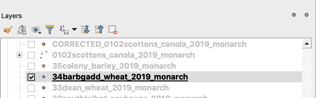
3. Sāciet saglabāšanas procesu
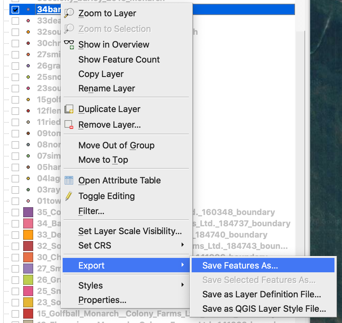
4. 1. Noklikšķiniet uz shapefile faila ar peles labo pogu
2. Izvēlieties Export -> Save Feature As ...
4. Izvēlieties
5. 1. Format -> ESRI Shapefile,
2. Filename -> noklikšķiniet uz … un izvēlieties vajadzīgo mapi un faila nosaukumu,
3. CRS -> EPSG:4326
4. Encoding -> UTF8
5. Add saved file to map (nav obligāti, ja vēlaties to uzreiz skatīt QGIS)
6. Geometry type -> Point
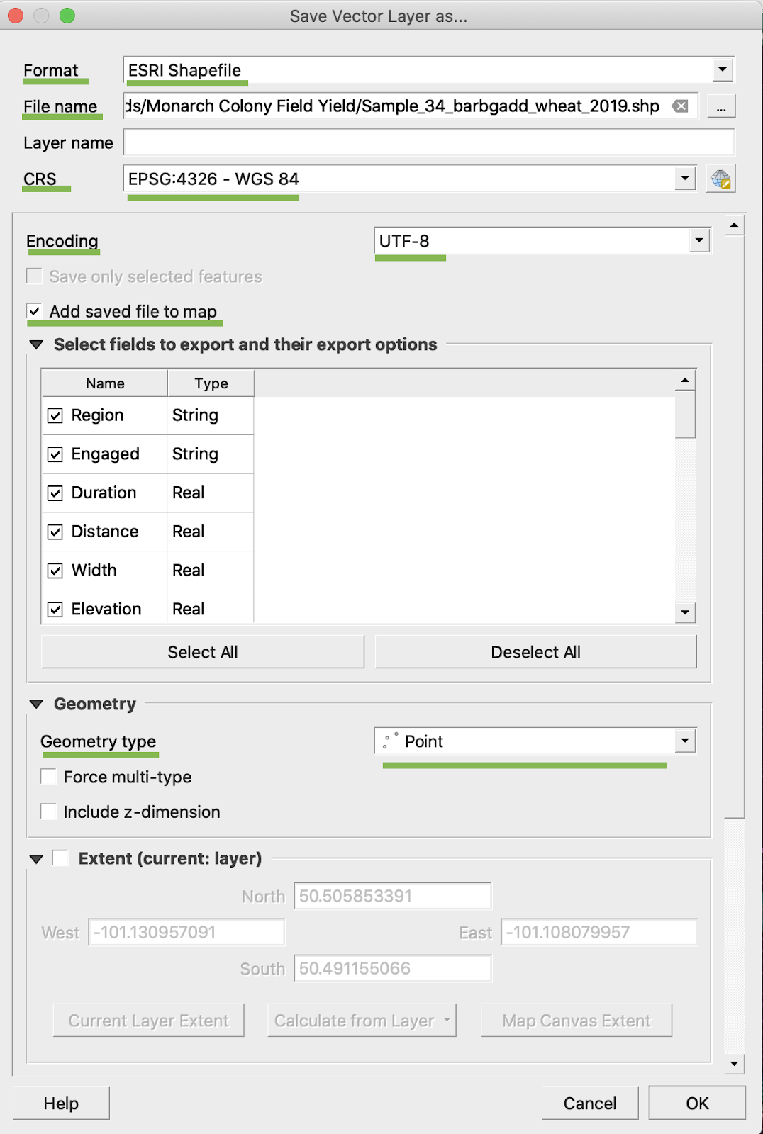
5. Noklikšķiniet uz Ok
6. Tiek izveidots papildu shapefile fails ar tiem pašiem ražas datiem. Tam ir pievienots projekcijas fails (.prj).
\
### PĀRRĒĶINS UZ BU/AC
1. Noklikšķiniet uz shapefile faila ar peles labo pogu un izvēlieties Open Attribute Table
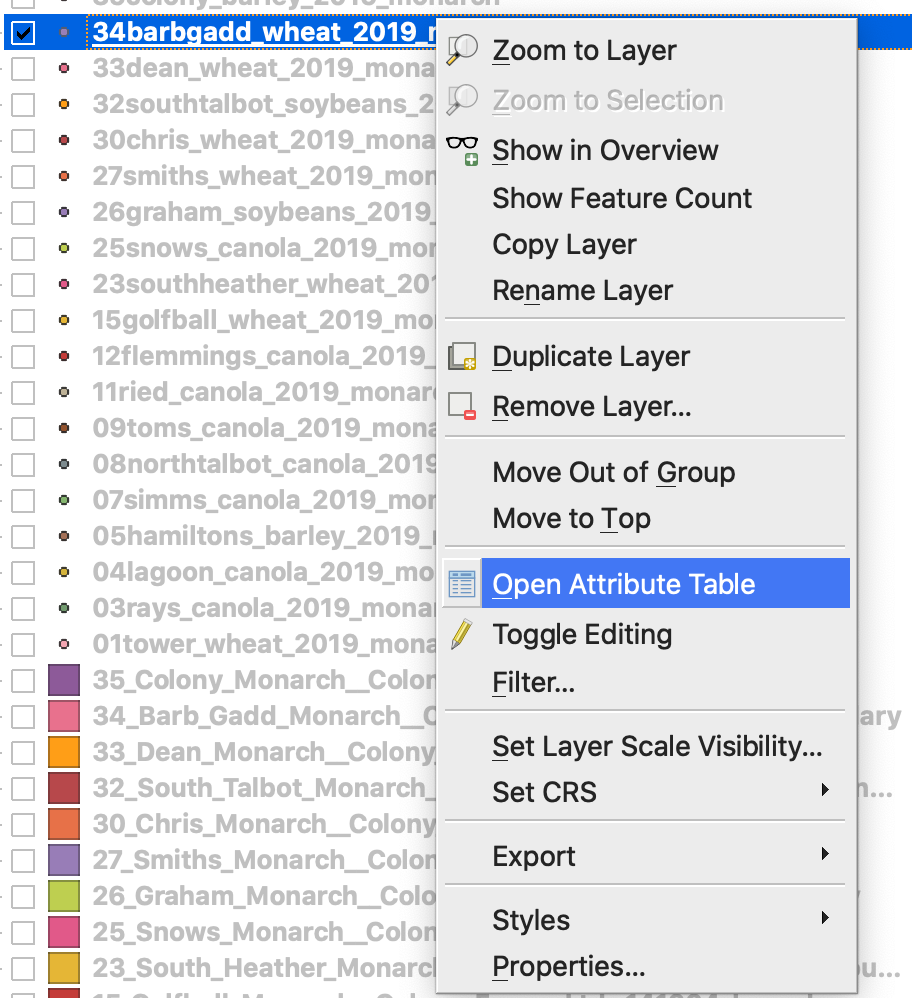
2. Noklikšķiniet uz Open field calculator
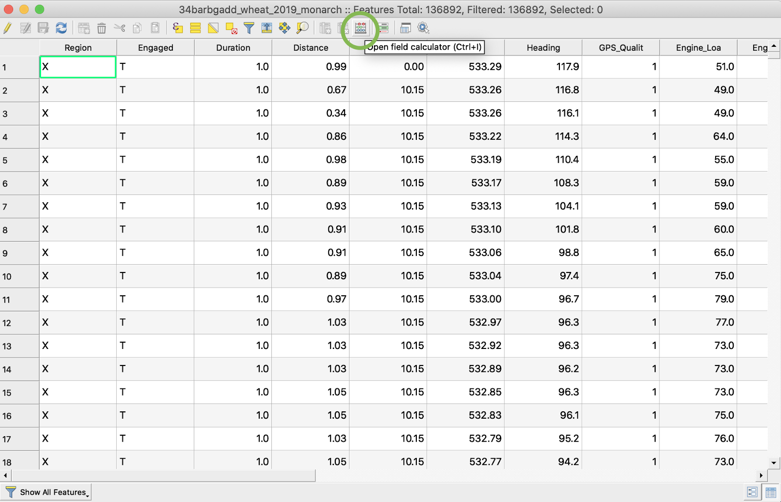
3. Izveidojiet jaunu lauku
4. 1. Atzīmējiet Create a new field
2. Ievadiet Output field name -> DryYieldBu
3. Izvēlieties Output field type -> Decimal number (real)
4. Iestatiet Precision -> 4
5. Ievadiet noteikumu pārrēķinam no kg/ha uz bu/ac -> "Dry\_Yield" \* 0.0149
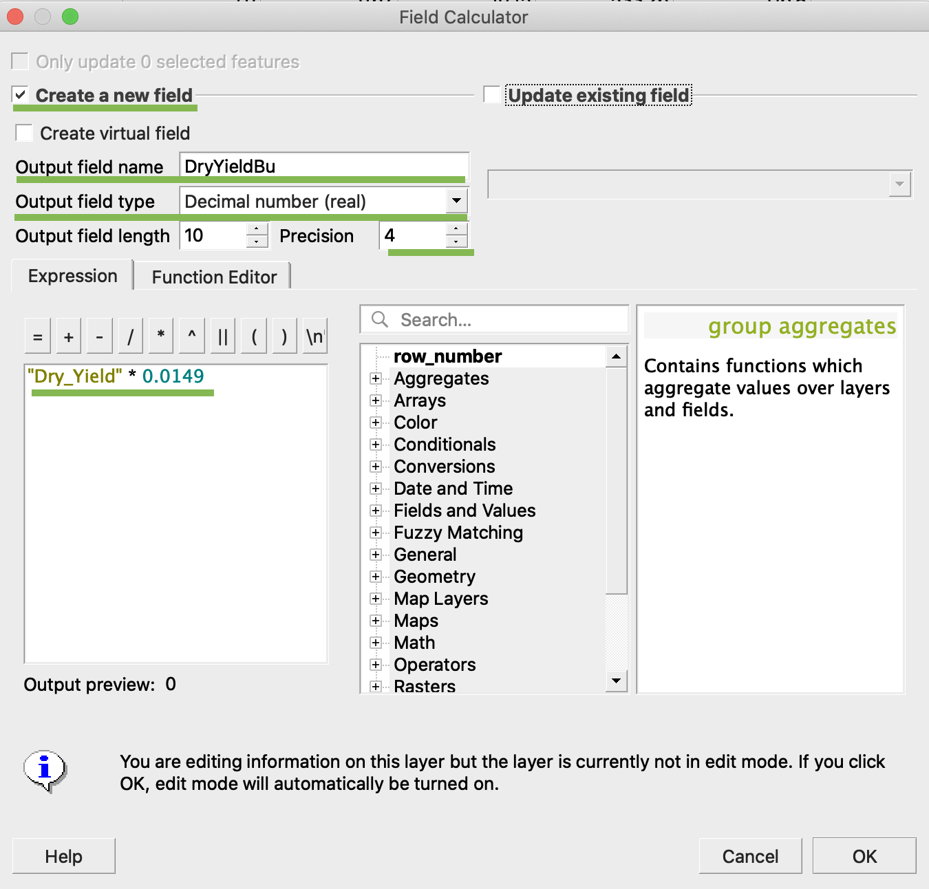
4. Noklikšķiniet uz Ok
5. Tabulā ir parādījies papildu atribūts DryYieldBu
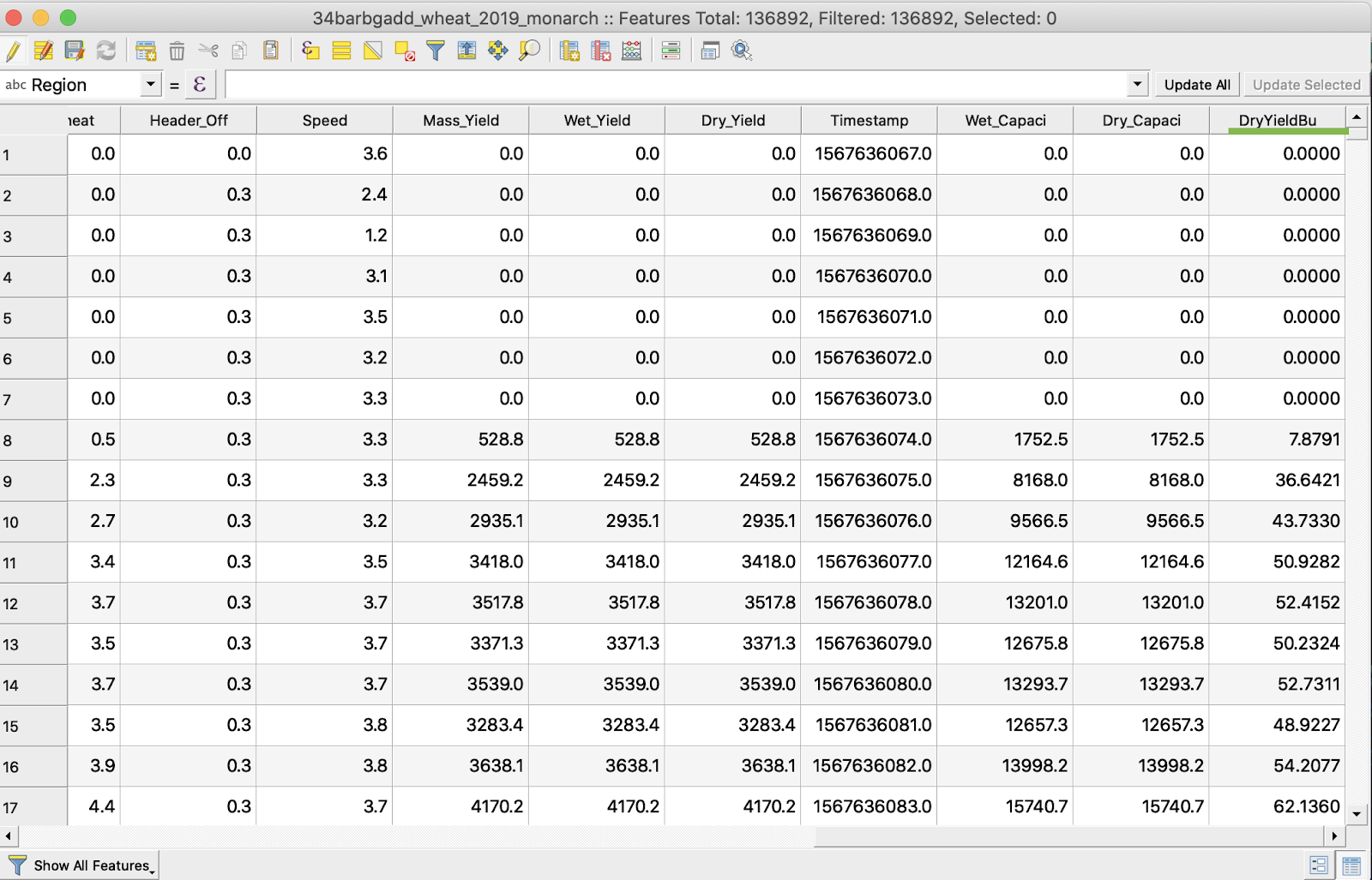
6. Saglabājiet izmaiņas
7. 1. Noklikšķiniet uz vajadzīgā shapefile faila ar peles labo pogu
2. Izvēlieties Toggle Editing
\
\
\
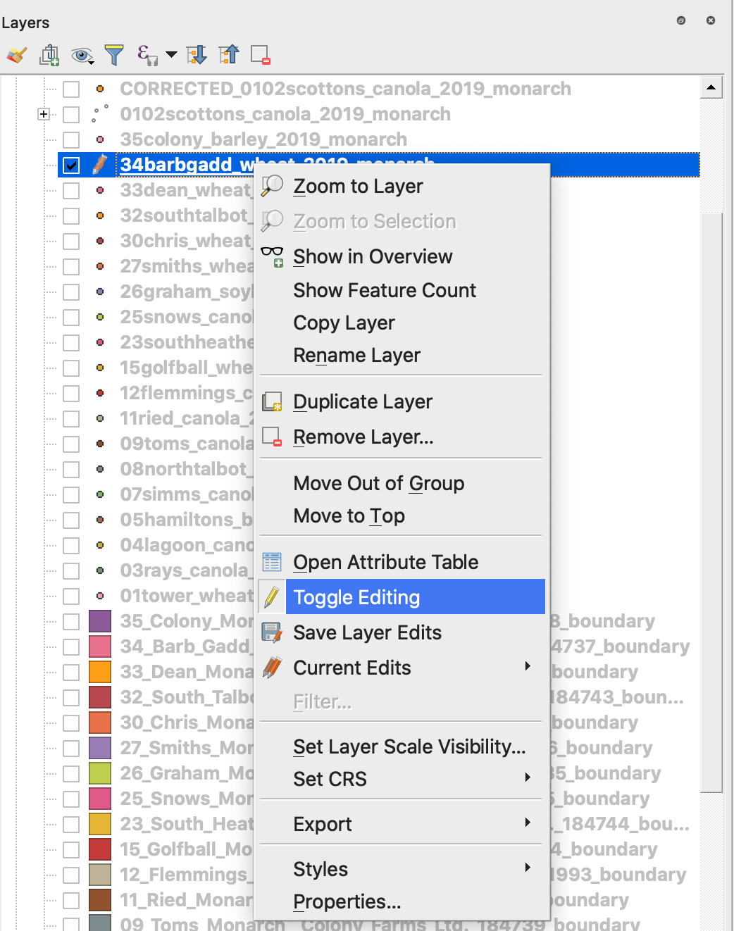
7. Apstipriniet izmaiņu saglabāšanu
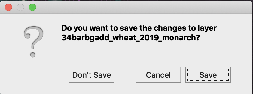
Vajadzīgais shapefile fails vairs nav atzīmēts ar zīmuļa ikonu. Shapefile dati ir atjaunināti.
---
# Agent Instructions
This documentation is published with GitBook. GitBook is the documentation platform designed so that both humans and AI agents can read, navigate, and reason over technical content effectively. Learn more at gitbook.com.
## Querying This Documentation
If you need additional information that is not directly available in this page, you can query the documentation by asking a question.
Perform an HTTP GET request on the following URL with the `ask` and `goal` query parameters:
```
GET https://docs.geopard.tech/geopard-tutorials/lva/gis-atrie-padomi/qgis-yield-data-manipulations.md?ask=&goal=
```
`ask` is the immediate question: it should be specific, self-contained, and written in natural language.
`goal` is what the user is ultimately trying to achieve, the reason they need the answer. Sharing it helps GitBook give you a better, more relevant answer. A goal is most helpful when it describes the outcome the user wants rather than restating the question. For example, with `ask=how do I create an API token`, a goal like `automate deployments from our CI pipeline` lets GitBook tailor the answer to that use case.
The response will contain a direct answer to the question and relevant excerpts and sources from the documentation.
Use this mechanism when the answer is not explicitly present in the current page, you need clarification or additional context, or you want to retrieve related documentation sections.