> For the complete documentation index, see [llms.txt](https://docs.geopard.tech/geopard-tutorials/llms.txt). Markdown versions of documentation pages are available by appending `.md` to page URLs; this page is available as [Markdown](https://docs.geopard.tech/geopard-tutorials/it/suggerimenti-rapidi-gis/qgis-manipolazioni-dei-dati-di-resa.md).
# QGIS: manipolazioni dei dati di resa
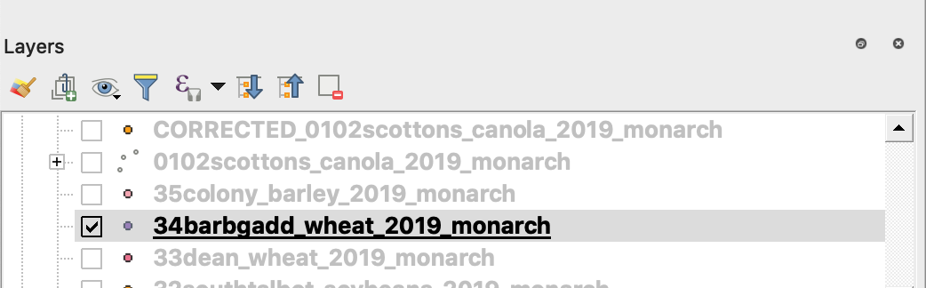
PANORAMICA
Manuale con descrizione passo passo per risolvere i seguenti problemi con i dati del monitor di resa:
1. File di proiezione (.prj) mancante nello shapefile
2. Applicare le regole di conversione per ogni attributo nello shapefile (basato su esempio da kb/ha a bu/ac)
Il software da utilizzare è QGIS ([LINK](https://qgis.org/en/site/forusers/download.html)).
Il download e l'installazione sono obbligatori.
### FILE DI PROIEZIONE MANCANTE
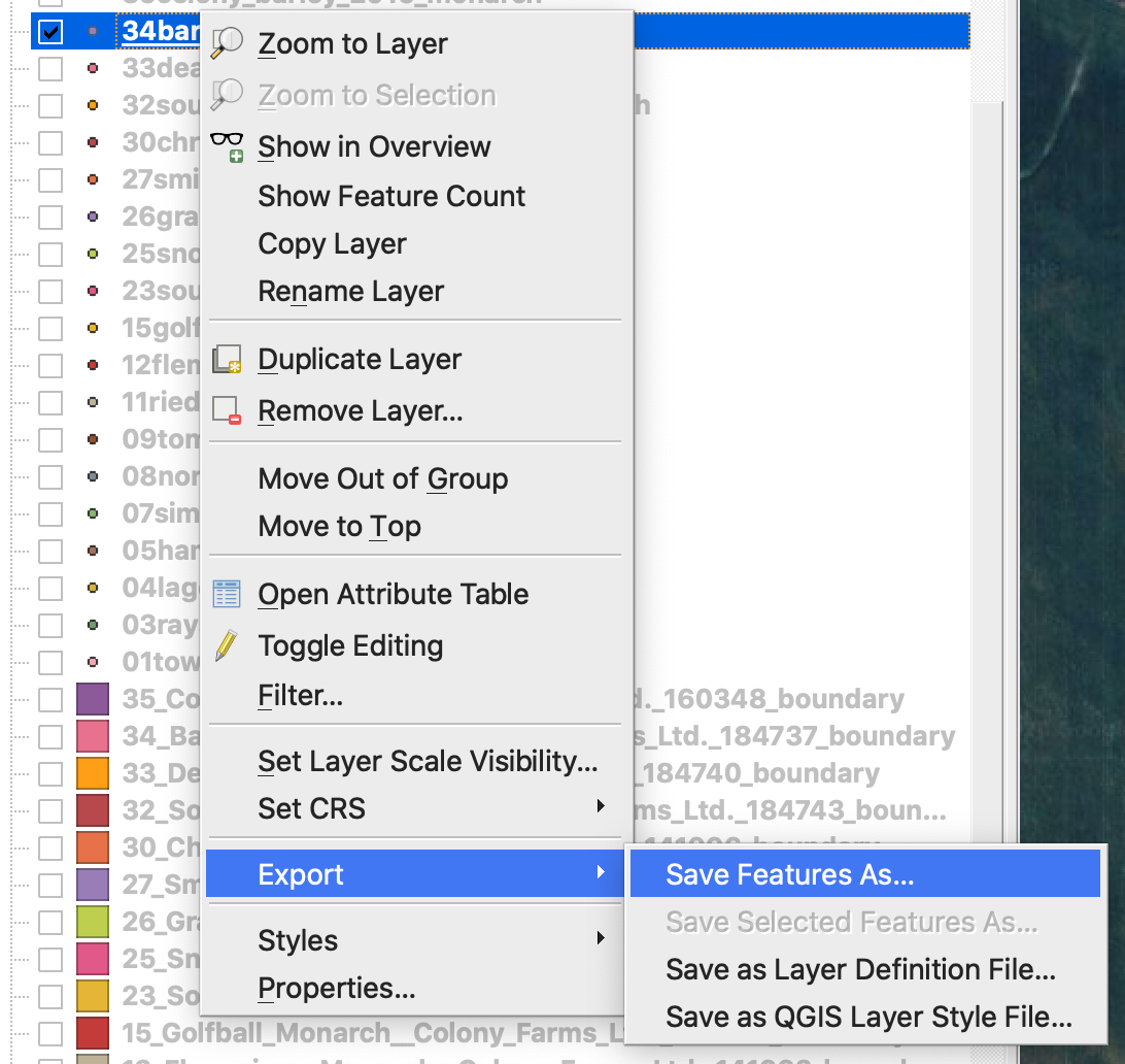
1. Aprire lo shapefile con i dati di resa. Spostare il file all'interno della finestra di QGIS.
2. Lo shapefile diventa disponibile per ulteriori manipolazioni nel blocco Layer.
3. Avviare il processo di salvataggio
4. 1. Fare clic con il tasto destro del mouse sullo shapefile
2. Scegliere Esporta -> Salva elementi come ...
4. Scegliere
5. 1. Formato -> ESRI Shapefile,
2. Nome file -> fare clic su … e selezionare la cartella e il nome file preferiti,
3. CRS -> EPSG:4326
4. Codifica -> UTF8
5. Aggiungi file salvato alla mappa (facoltativo se si desidera vederlo direttamente in QGIS)
6. Tipo di geometria -> Punto
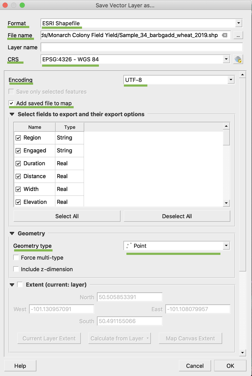
5. Fare clic su Ok
6. Viene creato uno shapefile aggiuntivo con gli stessi dati di resa. Il file di proiezione (.prj) è stato aggiunto.
\
### CONVERSIONE BU/AC
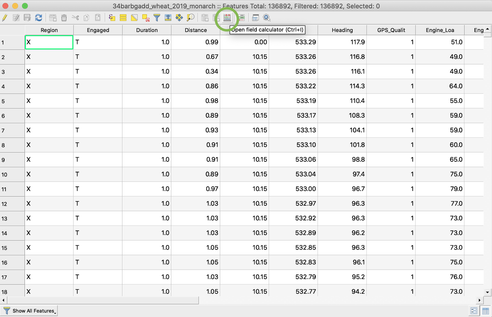
1. Fare clic con il tasto destro del mouse sullo shapefile e scegliere Apri tabella attributi
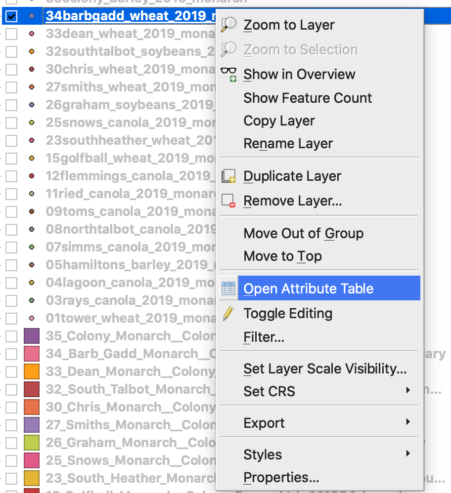
2. Fare clic su Apri calcolatore di campi
3. Creare un nuovo campo
4. 1. Selezionare Crea un nuovo campo
2. Inserire Nome campo di output -> DryYieldBu
3. Scegliere Tipo campo di output -> Numero decimale (reale)
4. Modificare Precisione -> 4
5. Inserire la regola per convertire kg/ha in bu/ac -> "Dry\_Yield" \* 0.0149
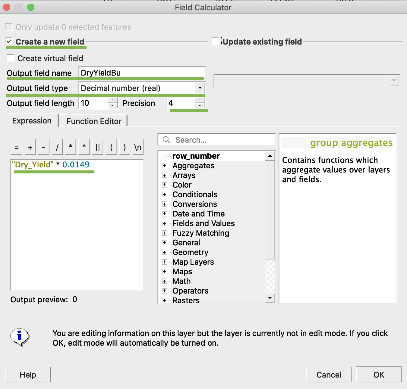
4. Fare clic su Ok
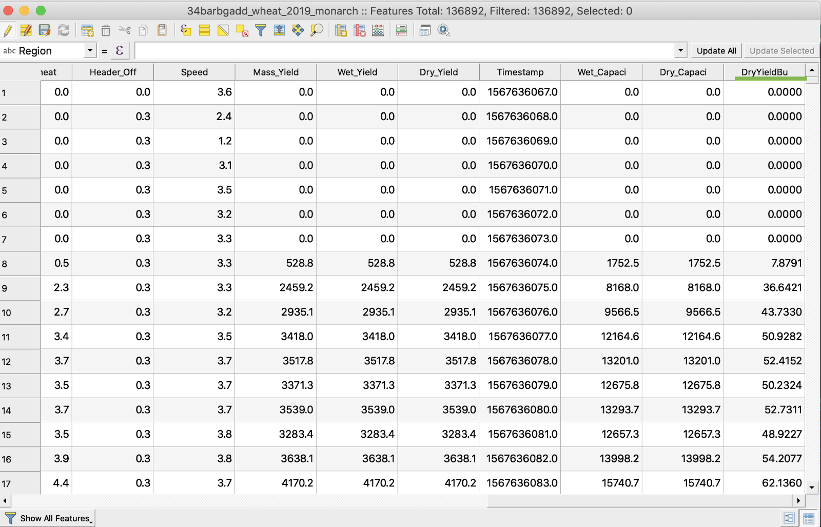
5. Nella tabella è apparso l'attributo aggiuntivo DryYieldBu
6. Salvare le modifiche
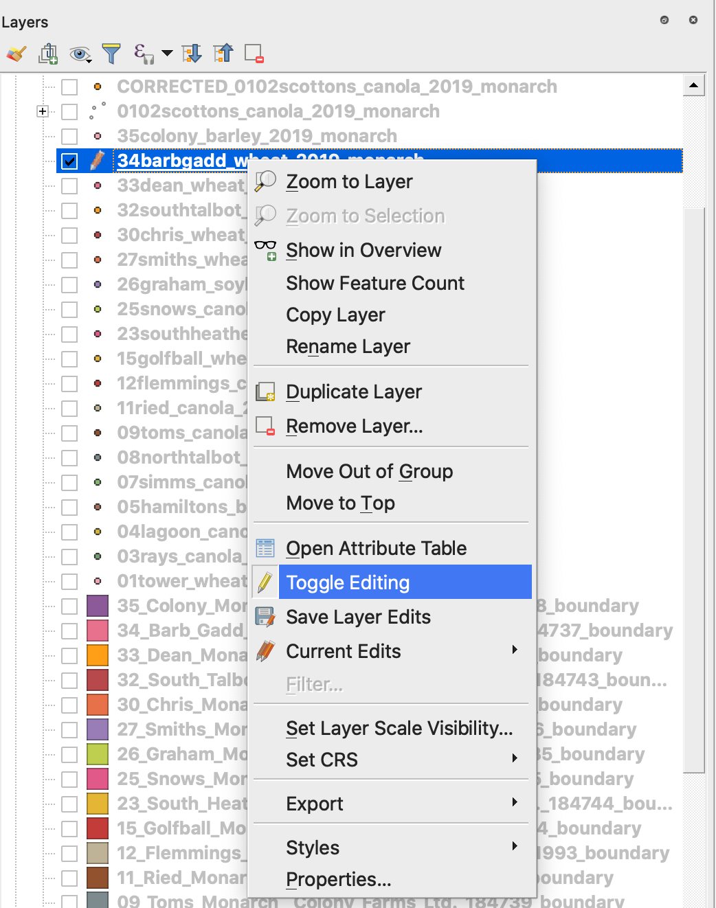
7. 1. Fare clic con il tasto destro del mouse sullo shapefile interessato
2. Scegliere Attiva/disattiva modifica
\
\
\
7. Confermare il salvataggio delle modifiche
Lo shapefile interessato non è più contrassegnato con la matita. I dati nello shapefile sono stati aggiornati.
---
# Agent Instructions
This documentation is published with GitBook. GitBook is the documentation platform designed so that both humans and AI agents can read, navigate, and reason over technical content effectively. Learn more at gitbook.com.
## Querying This Documentation
If you need additional information that is not directly available in this page, you can query the documentation dynamically by asking a question.
Perform an HTTP GET request on the current page URL with the `ask` query parameter, and the optional `goal` query parameter:
```
GET https://docs.geopard.tech/geopard-tutorials/it/suggerimenti-rapidi-gis/qgis-manipolazioni-dei-dati-di-resa.md?ask=&goal=
```
`ask` is the immediate question: it should be specific, self-contained, and written in natural language.
`goal` is optional and describes the broader end goal you are ultimately trying to accomplish on behalf of the user. GitBook uses it to tailor the answer towards what is most useful for that goal.
The response will contain a direct answer to the question and relevant excerpts and sources from the documentation.
Use this mechanism when the answer is not explicitly present in the current page, you need clarification or additional context, or you want to retrieve related documentation sections.