> For the complete documentation index, see [llms.txt](https://docs.geopard.tech/geopard-tutorials/llms.txt). Markdown versions of documentation pages are available by appending `.md` to page URLs; this page is available as [Markdown](https://docs.geopard.tech/geopard-tutorials/it/suggerimenti-rapidi-gis/qgis-calcola-lndvi-per-il-file-geotiff-del-drone.md).
# QGIS: calcola l'NDVI per il file GeoTIFF del drone
A volte è necessario calcolare la NDVI media per un poligono all’interno del campo. È possibile fare quanto segue in un programma QGIS.
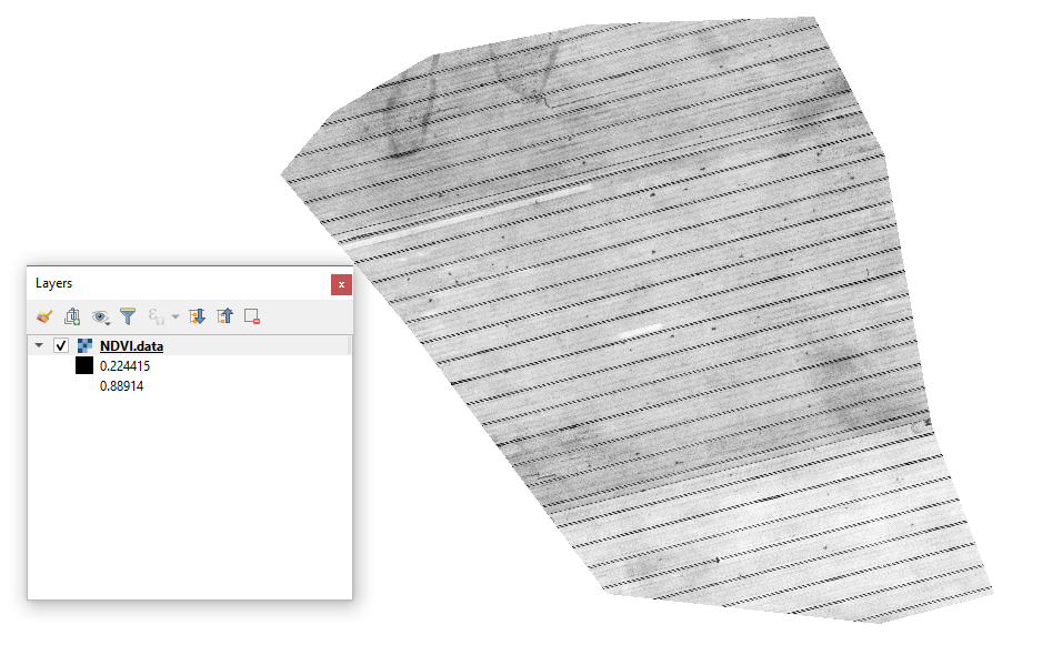
#### 1 - Visualizza il geotiff NDVI iniziale del drone
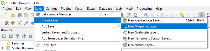
#### 2 - Crea un nuovo layer
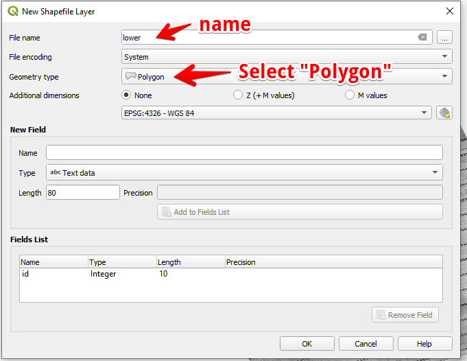
#### 3 - Imposta il nome del layer e il tipo di geometria, quindi premi OK
#### 4 - Seleziona il layer nel pannello Layer
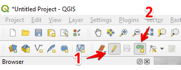
1. Seleziona “Attiva modifica” (1)
2. Seleziona “Aggiungi feature poligonale” (2)
#### 5 - Disegna un poligono. Per terminare il disegno premi il tasto destro del mouse e imposta “id” nel popup.
Termina il layer premendo di nuovo “Attiva modifica” e premi “Salva”.
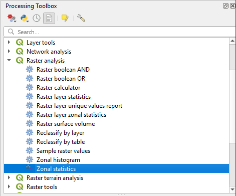
#### 6 - Seleziona Statistiche zonali nel pannello “Casella degli strumenti di elaborazione”.
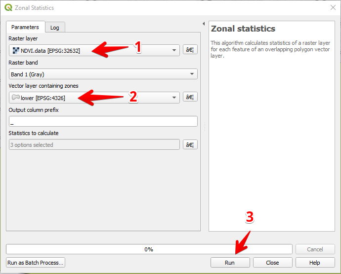
#### 7 - Seleziona il layer raster (1),
Seleziona il layer poligonale (2),
Premi “Esegui” (3).
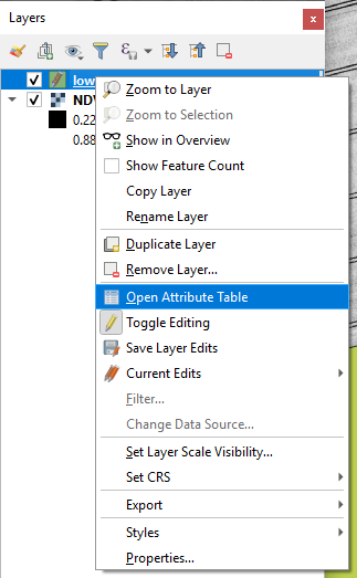
#### 8 - Seleziona il layer nel pannello Layer e premi il tasto destro del mouse; nel menu contestuale seleziona Apri tabella degli attributi.
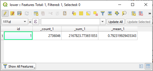
#### 9 - Le statistiche calcolate verranno mostrate nella tabella.
---
# Agent Instructions
This documentation is published with GitBook. GitBook is the documentation platform designed so that both humans and AI agents can read, navigate, and reason over technical content effectively. Learn more at gitbook.com.
## Querying This Documentation
If you need additional information that is not directly available in this page, you can query the documentation dynamically by asking a question.
Perform an HTTP GET request on the current page URL with the `ask` query parameter, and the optional `goal` query parameter:
```
GET https://docs.geopard.tech/geopard-tutorials/it/suggerimenti-rapidi-gis/qgis-calcola-lndvi-per-il-file-geotiff-del-drone.md?ask=&goal=
```
`ask` is the immediate question: it should be specific, self-contained, and written in natural language.
`goal` is optional and describes the broader end goal you are ultimately trying to accomplish on behalf of the user. GitBook uses it to tailor the answer towards what is most useful for that goal.
The response will contain a direct answer to the question and relevant excerpts and sources from the documentation.
Use this mechanism when the answer is not explicitly present in the current page, you need clarification or additional context, or you want to retrieve related documentation sections.