> For the complete documentation index, see [llms.txt](https://docs.geopard.tech/geopard-tutorials/llms.txt). Markdown versions of documentation pages are available by appending `.md` to page URLs; this page is available as [Markdown](https://docs.geopard.tech/geopard-tutorials/fin/tuote-esittely-verkkosovellus/export-download.md).
# Vienti / lataus
GeoPard ei lukitse dataasi sisään. Voit ladata raakadatan ja analytiikan milloin tahansa, eräajona, käyttöliittymästä tai API:n kautta.
Tuetut vientitiedostomuodot löydät [Tietojen yhteensopivuus -sivulta](https://geopard.tech/data-compatibility/).
{% hint style="success" %}
Kokeile viedä karttoja ja levitysohjeita omille peltolohkoillesi: [Aloita maksutta](https://app.geopard.tech/auth/sign-up?utm_source=docs\&utm_medium=cta\&utm_campaign=export-download)
{% endhint %}
Raven Slingshot ja Viper Pro 4 – shapefile-tiedostot
Trimble – shapefile-tiedostot ja ISOXML
John Deere GS3- ja GS4-tiedot ([GS3:n tiedot](https://stellarsupport.deere.com/site_media/pdf/en/manuals/gs3_2630/ompfp13946_j3_19_25oct13_402dcy.pdf), [GS4:n tiedot](https://www.deere.com/assets/pdfs/common/stellarsupport/Gen4CommandCenter_ReleaseNotes_16-1_English.pdf))
John Deere – integroitu MyJD Ops Center, katso lisätiedot blogikirjoituksestamme
AGCO – ISOXML ja shapefile-tiedostot
CNH – ISOXML/shapefile-tuki:\
\&#xNAN;*CNH Voyager 2 tai Case Pro 700 – ISOXML*\
\&#xNAN;*Case IH -näytöt – laiteohjelmistoversio 30.6.0.0 tai uudempi – shapefile-yhteensopivuus* [lisätiedot](https://assets.cnhindustrial.com/caseih/NAFTA/NAFTAASSETS/Products/Advanced-Farming-Systems/Brochures/AFS%20Precision%20Farming%20Catalog_05-07-2019_PM-18308.pdf)
Topcon/TAP – shapefile-tuettu
Mueller-näytöt – ISOXML/shapefile-tuettu, [lisätiedot](https://www.mueller-elektronik.de/pm_manuals/TRACK-Leader%20f%C3%BCr%20Tasten-Terminals/de/701717643.html)
ISOXML (Claas, Topcon, Dickey John, CNH ja muut)
AgLeader-näytöt – shapefile-tuki, [lisätiedot](https://www.agleader.com/blog/loading-prescription-files-into-ag-leader-integra-and-versa-displays/?locale=en)
 Amazone / Amatron – shapefile, ISOXML ([Amatron 3:n tiedot](https://et.amazone.de/files/pdf/MG5560-EN-II.pdf), [Amatron 4:n tiedot](https://et.amazone.de/files/pdf/MG6010-EN-II.pdf))
GeoJSON – yleinen vektoridatamuoto. Useimmat GIS-ohjelmat, kuten Esri ArcGIS ja QGIS, tukevat sitä. Saatavilla API-käyttäjille.
Shapefile – yleinen vektoridatamuoto. Useimmat GIS-ohjelmat, kuten Esri ArcGIS ja QGIS, tukevat sitä.
API / widgetit GeoPard-analytiikan integrointiin muihin järjestelmiin.
### **Peltolohkojen rajojen vienti**
Jos haluat viedä peltolohkosi tai peltolohkojesi shapefile-tiedoston, valitse **Vie tiedot** ja siirry **Lataa tiedostoja** -välilehdelle.
1. Laajenna haluamasi maatila ja peltolohko. Valitse puurakenteesta vietävä raja ja napsauta sitten **Lataa** tai **Lataa valitut** , jos haluat viedä useita valittuja tasoja kerralla.
Valittu raja ladataan tietokoneellesi .shp-tiedostona .zip-arkistossa, jonka voit ladata työkoneeseen.
### **Vyöhykekarttojen vienti**
GeoPardilla voit viedä peltolohkojesi vyöhykekarttoja, joihin on liitetty paikkakohtaiset levitysohjeet täsmäviljelyä varten.
Napsauta **Vie tiedot** -valikkokohtaa. Siirry sitten **Lataa tiedostoja** -välilehdelle.
1. Laajenna haluamasi maatila ja peltolohko. Valitse puurakenteesta vietävät vyöhykekartat ja napsauta sitten **Lataa** tai **Lataa valitut** jos haluat viedä useita valittuja karttoja kerralla.
Valittujen vyöhykekarttojen tiedostot ladataan tietokoneellesi .zip-arkistona, joka sisältää .shp-tiedoston. Voit ladata arkiston koneen ohjausjärjestelmään.
### Vie peltokokeet
Kokeet viedään niihin liittyvän **vyöhykekartan**.
GeoPard vie kokeen ja siihen liittyvän vyöhykekartan yhtenä konekäyttöön valmiina tasona. Näin käsittelyt pysyvät paikkatietoon sidottuina ja valmiina koneella toteutettaviksi tai myöhemmin analysoitaviksi.
Toimi näin:
1. Avaa lohko ja siirry **vyöhykekarttaan,** johon tallennettu koe sisältyy.
2. Valitse **Vie** vyöhykekarttasivulla.
3. Valitse tarvitsemasi tulostusmuoto:
* **ISOXML** yhteensopiville päätelaitteille ja ohjaimille
* **John Deere -vienti** kun haluat lähettää levityskartan Operations Centeriin
* **Shapefile** kun tarvitset paikkatieto-ohjelmistoon tai koneen ohjaimeen sopivan vektoritiedoston
4. Lataa viety tiedosto ja tuo se koneesi työnkulkuun.
{% hint style="info" %}
Kokeita ei viedä erillisenä itsenäisenä tasona. Ne viedään yhdistettynä niihin liittyvään vyöhykekarttaan.
{% endhint %}
Aiheeseen liittyviä sivuja:
* [Peltokokeiden suunnittelu ja luominen](https://docs.geopard.tech/geopard-tutorials/fin/tuote-esittely-verkkosovellus/on-farm-trials-design-and-creation.md)
* [Vie VRA-kartta ISOXML-muodossa](https://docs.geopard.tech/geopard-tutorials/fin/tuote-esittely-verkkosovellus/export-download/export-vra-map-in-isoxml-format.md)
* [Vie levityskartat tiedostoina John Deere Operations Centeriin](https://docs.geopard.tech/geopard-tutorials/fin/tuote-esittely-verkkosovellus/john-deere-operations-center-integration/6.-export-rx-maps-to-john-deere-operations-center-as-files.md)
* [Vie levityskartat työsuunnitelmina John Deere Operations Centeriin](https://docs.geopard.tech/geopard-tutorials/fin/tuote-esittely-verkkosovellus/john-deere-operations-center-integration/8.-export-rx-maps-to-john-deere-operations-center-as-work-plans.md)
### Vie VRA-kartta ISOXML-muodossa
GeoPard tukee vientiä ISOBUS- / ISOXML- ([ISO 11783-1:2017](https://www.iso.org/standard/57556.html))-tietomuodoissa.
Vientiohjeet:
1. Valitse "Siirry vyöhykekarttasivulle"
2. Valitse "Vie"
3. Lataa ISOXML
4. Ladatun `.zip` tiedoston pitäisi näyttää tältä. Se sisältää kaikki kolme ISOXML-versiota. Valitse oikea versio näyttöpäätteen teknisten tietojen perusteella.
Valmis ISOXML-vientiin sisältyvä ZIP-tiedosto näyttää tältä
### **Vie MyJohnDeere-palveluun**
GeoPard-käyttäjät voivat viedä esimerkiksi levityskarttoja ja muita karttatasoja John Deere Operations Centeriin.
Voit viedä aineistoja valitsemalla **Vie dataa** -valikkokohdan. Valitse **To MyJohnDeere**.
1. Valitse kohdeorganisaatio, johon GeoPard lataa tiedostot. Jos oikeaa organisaatiota ei ole valittavissa, siirry **Täällä voit muuttaa organisaation** linkkiä ja lisätä organisaatioita. Jos John Deere -organisaatio ei ole käytettävissä (sen nimi näkyy harmaana), lisää käyttöoikeus John Deere Operations Centerissä. Napsauta **Seuraava**.
2. Valitse aineistot, jotka GeoPard lataa John Deere Operations Centeriin. Voit suodattaa aineistoja. Kun olet valinnut kaikki haluamasi aineistot, voit ladata ne kaikki napsauttamalla **Vie kaikki** -painiketta tai ladata yksittäisiä aineistoja napsauttamalla **Vie** -painiketta.
Napsautuksen jälkeen näet viestin toiminnon tuloksesta. Tämän jälkeen tulos näkyy John Deere Operations Centerissä.
### **Yhtälöiden vienti**
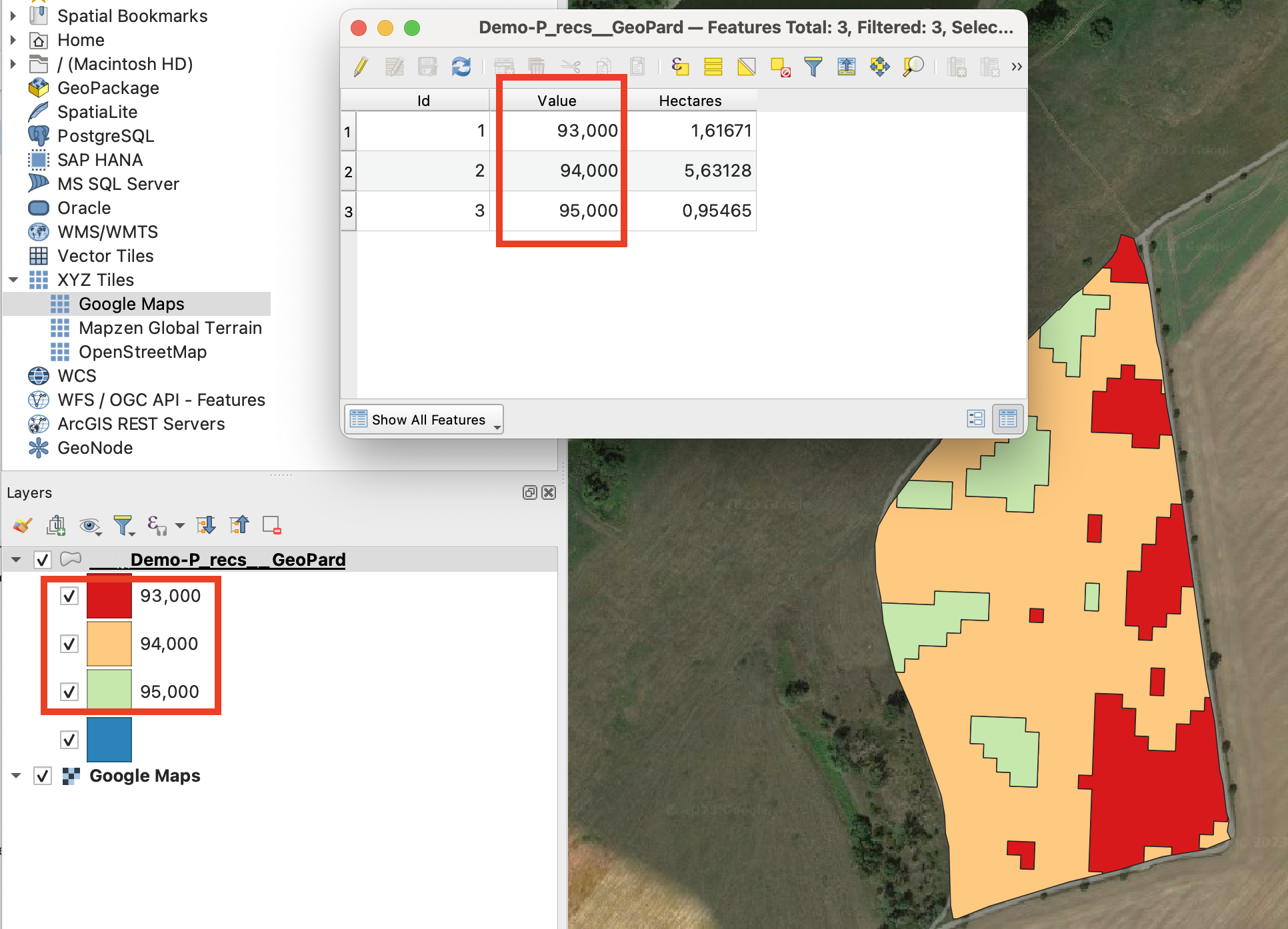
Yhtälökartan voi nyt ladata siten, että tiedot yhdistetään arvojen perusteella monikulmioiksi.\
Muutaman levitysmäärän yhtälökartta viedään esimerkiksi näin:
Näin koneen ei tarvitse vaihtaa vyöhykettä kovin usein.\
\
Voit ladata tällaisia arkistoja käyttämällä seuraavaa toimintoa:\
\
\
Huomaa: Emme ole vielä päivittäneet "Vie John Deere -tililleni tiedostoina" -toimintoa tukemaan tätä ominaisuutta.
---
# Agent Instructions
This documentation is published with GitBook. GitBook is the documentation platform designed so that both humans and AI agents can read, navigate, and reason over technical content effectively. Learn more at gitbook.com.
## Querying This Documentation
If you need additional information that is not directly available in this page, you can query the documentation by asking a question.
Perform an HTTP GET request on the following URL with the `ask` and `goal` query parameters:
```
GET https://docs.geopard.tech/geopard-tutorials/fin/tuote-esittely-verkkosovellus/export-download.md?ask=&goal=
```
`ask` is the immediate question: it should be specific, self-contained, and written in natural language.
`goal` is what the user is ultimately trying to achieve, the reason they need the answer. Sharing it helps GitBook give you a better, more relevant answer. A goal is most helpful when it describes the outcome the user wants rather than restating the question. For example, with `ask=how do I create an API token`, a goal like `automate deployments from our CI pipeline` lets GitBook tailor the answer to that use case.
The response will contain a direct answer to the question and relevant excerpts and sources from the documentation.
Use this mechanism when the answer is not explicitly present in the current page, you need clarification or additional context, or you want to retrieve related documentation sections.