> For the complete documentation index, see [llms.txt](https://docs.geopard.tech/geopard-tutorials/llms.txt). Markdown versions of documentation pages are available by appending `.md` to page URLs; this page is available as [Markdown](https://docs.geopard.tech/geopard-tutorials/bg/brzi-gis-sveti/qgis-preobrazuvane-na-csv-v-shp.md).
# QGIS: Преобразуване на CSV в SHP
Преобразувайте CSV точкови данни в shapefile в QGIS за импорт в GeoPard и GIS използване.
Урокът помага за конвертиране на CSV в SHP (shapefile). По-долу са описани стъпките как да направите това с [QGIS](https://www.qgis.org/en/site/) десктоп софтуер.
**ВАЖНО**: Данните във формат CSV трябва да съдържат `дължина` и `ширина` колони, за да се направи правилното георефериране.
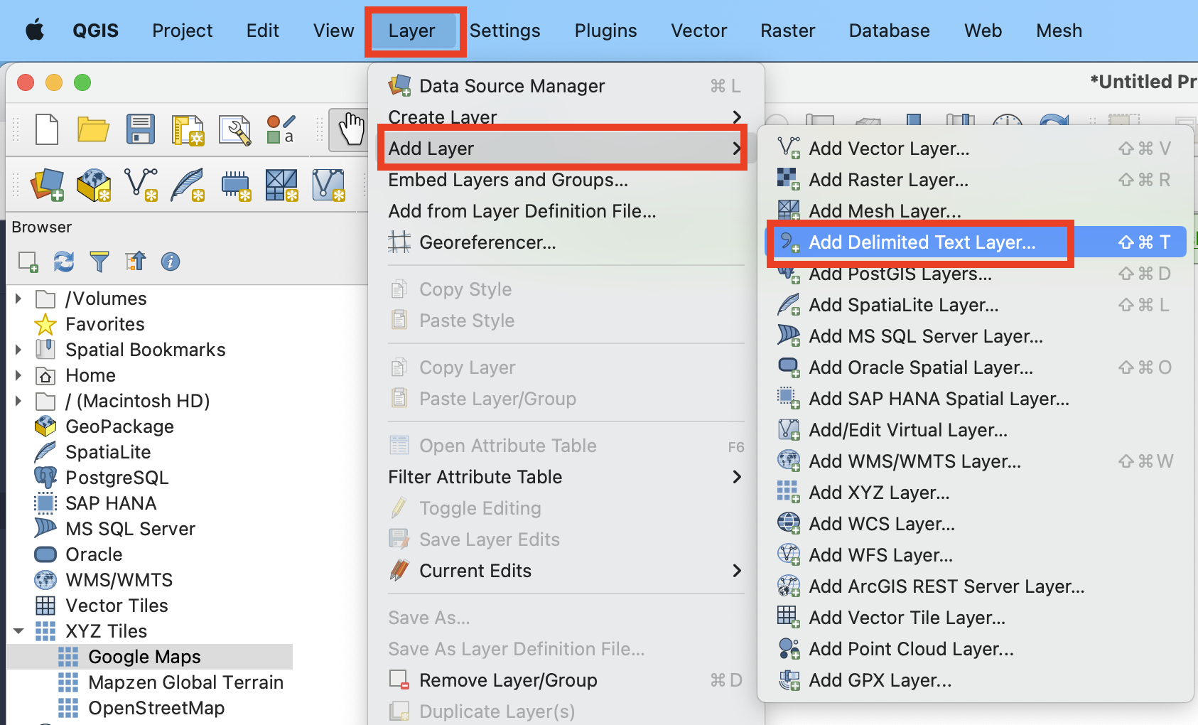
**СТЪПКА 1**: Стартирайте процеса на импортиране чрез "Layer" >> "Add Layer" >> "Add Delimited Text Layer".
**СТЪПКА 2**: Конфигурирайте параметрите за импортиране и щракнете върху бутона "Add".
1. Посочете пътя до CSV файла
2. Проверете разделителя на колоните — трябва да е запетая.
3. Проверете първия ред. Обикновено той съдържа имената на атрибутите. Той трябва да бъде изключен от парсването.
4. Изберете колоните от набора с данни с Latitude (X) и Longitude (Y) данни.
5. Задайте координатната референтна система. Обикновено се използва ESPG:4326.
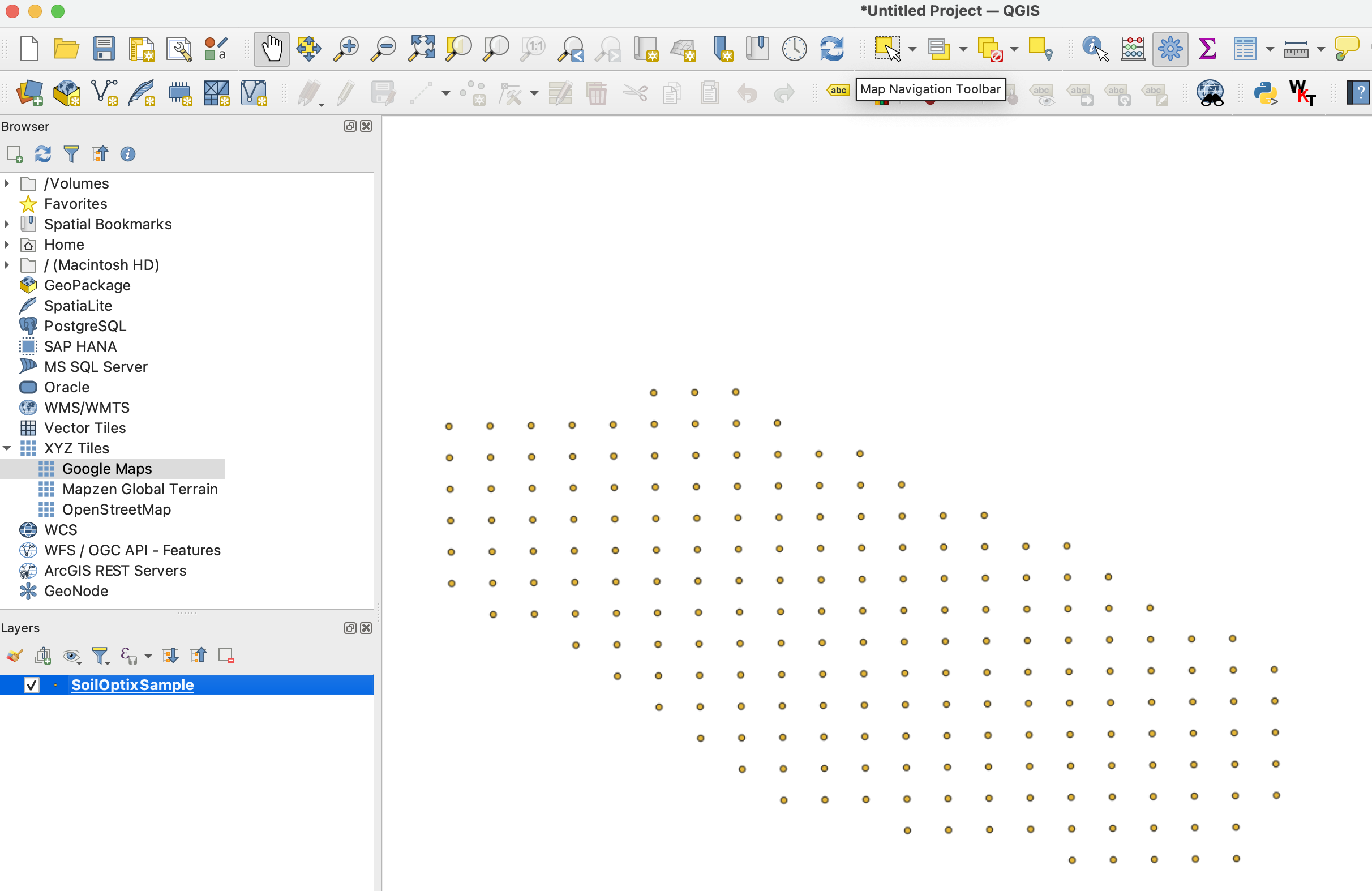
Очакваният резултат след **СТЪПКА 2** изглежда като
**СТЪПКА 3**: Стартирайте експортирането чрез щракване с "десен бутон на мишката" >> "Export" >> "Save Features As ..."
**СТЪПКА 4**: Конфигурирайте правилните опции за експортиране и щракнете върху "Ok".
1. Задайте пътя до експортирания shapefile.
2. Задайте координатната референтна система (CRS) на ESPG:4326, която се приема от GeoPard.
---
# Agent Instructions
This documentation is published with GitBook. GitBook is the documentation platform designed so that both humans and AI agents can read, navigate, and reason over technical content effectively. Learn more at gitbook.com.
## Querying This Documentation
If you need additional information that is not directly available in this page, you can query the documentation by asking a question.
Perform an HTTP GET request on the following URL with the `ask` and `goal` query parameters:
```
GET https://docs.geopard.tech/geopard-tutorials/bg/brzi-gis-sveti/qgis-preobrazuvane-na-csv-v-shp.md?ask=&goal=
```
`ask` is the immediate question: it should be specific, self-contained, and written in natural language.
`goal` is what the user is ultimately trying to achieve, the reason they need the answer. Sharing it helps GitBook give you a better, more relevant answer. A goal is most helpful when it describes the outcome the user wants rather than restating the question. For example, with `ask=how do I create an API token`, a goal like `automate deployments from our CI pipeline` lets GitBook tailor the answer to that use case.
The response will contain a direct answer to the question and relevant excerpts and sources from the documentation.
Use this mechanism when the answer is not explicitly present in the current page, you need clarification or additional context, or you want to retrieve related documentation sections.